
 | ||
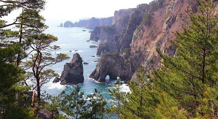
The Sanriku Coast (三陸海岸, sanriku kaigan) is a coastal region on the Pacific Ocean, extending from southern Aomori prefecture, through Iwate prefecture and northern Miyagi prefecture in northeastern Honshū, which is Japan's main island. The name comes from the historical region of Sanriku (or "three riku"), referring to the former provinces of Rikuō, Rikuchū and Rikuzen.
Contents
Map of Sanriku-kaigan, Japan
Tourist destination
There are the Tanesashi Coast, the Rikuchu Kaigan National Park and the Minami-Sanriku Kinkazan Quasi-National Park in the Sanriku Coast region.
Earthquakes and tsunami
The bays of this ria coastline tend to amplify the destructiveness of tsunami waves. Significant events which devastated coastal communities include:
Prior to 2011, the tsunami history of Sanriku might have been interpreted as a story of progressively fewer casualties due to human intervention and planning. The 2011 disaster created a new baseline for analysis of regularly occurring tsunamis.