
Autonomous region Guangxi Time zone China Standard (UTC+8) Area 2,430 km² Population 297,244 (2010) | Postal code 5455XX Local time Wednesday 1:16 AM | |
 | ||
Country People's Republic of China Weather 12°C, Wind W at 2 km/h, 98% Humidity Points of interest Sanjiang Drum Tower, Chengyangqiao Scenic Area, Sanjiang Dong Ethnic Minority Group Museum | ||
Sanjiang Dong Autonomous County (simplified Chinese: 三江侗族自治县; traditional Chinese: 三江侗族自治縣; pinyin: Sānjiāng Dòngzú Zìzhìxiàn; Standard Zhuang: Sanhgyangh Dungcuz Swciyen) is under the administration of Liuzhou, Guangxi Zhuang Autonomous Region, China. It is a region traditionally inhabited by the Dong people, bordering the prefecture-level divisions of Qiandongnan (Guizhou) to the north, Huaihua (Hunan) to the northeast and Guilin to the west.
Contents
Map of Sanjiang, Liuzhou, Guangxi, China
It has an area of 2454 square kilometers and a population of 350,000.
Transportation
Tourism
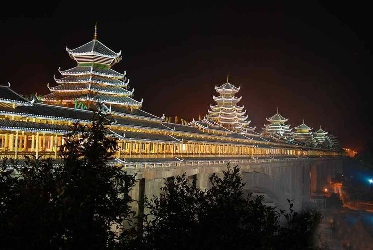
20 km north of Sanjiang, toward Hunan province, lies the Dong district, Chengyang (程阳) which is becoming a popular tourist destination with backpackers. The district comprises eight traditional Dong minority villages. The houses are all made of wood. Inside the villages you will find traditional drum towers, which were used to announce important things or simply to perform plays to entertain the villagers. Crossing the river is the best preserved Wind and Rain Bridge (程阳风雨桥, chéng yáng fēng yǔ qiáo) which has five parts. The bridge dates to the 1920s and is for many people the main reason to visit the village.
North of Chengyang lies the tiny village of Linxia which is interesting because of the local market. There are no places to stay in Linxia, but a taxi from Sanjiang or Chengyang brings you there easily.