
Island group Sangihe Islands | ||
 | ||
Part 11 harmonising tahuna bay the prospect of ecotourism in sangihe islands
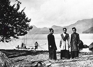
Sangir Besar, commonly called Sangir Island (with the spelling variants "Sangihe", "Sanghir" or "Sangi"), is an island in the Sangir Islands group. Its Indonesian name literally means "Great Sangir", in reference to the fact that it is the archipelago's main island. It is part of the North Sulawesi province. The main language is the Sangir language.
Contents
- Part 11 harmonising tahuna bay the prospect of ecotourism in sangihe islands
- Map of Sangihe Island Kepulauan Sangihe Regency North Sulawesi Indonesia
- Best preview sangihe island
- References
Map of Sangihe Island, Kepulauan Sangihe Regency, North Sulawesi, Indonesia
It was the scene of the violent eruption of Gunung Awu volcano in March, 1856. The existing mountain was reshaped by the eruption, and flooding was extensive. The death toll was estimated to exceed two thousand, possibly as high as 6,000. Other major eruptions occurred in 1966 and 2004.
Best preview sangihe island
References
Sangir Island Wikipedia(Text) CC BY-SA