
OS grid reference TL1649 Dialling code 01767 | Local time Tuesday 1:29 PM | |
 | ||
Population 10,887 (2001)11,657 (2011 Census) Weather 10°C, Wind W at 29 km/h, 50% Humidity | ||
Sandy is a small market town and civil parish in Bedfordshire, England. It is frequently referred to as "the high mark of Bedfordshire" It lies between Cambridge and Bedford, on the A1 road from London to Edinburgh. The area is dominated by a range of low hills known as the Sand Hills. The River Ivel runs through the town. The Anglican church is dedicated to St Swithun.
Contents
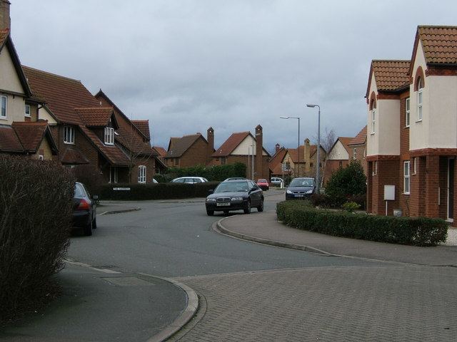
- Map of Sandy UK
- History
- Education
- Schools in Sandy
- Government
- Road
- Rail
- Past and Future rail links
- Twinned towns
- Commemoration
- References
Map of Sandy, UK
Sandy is probably best known today as the headquarters of the RSPB. The Society moved to the Lodge, on the outskirts of the town, in 1961. The Shuttleworth Collection is also nearby, around 2 miles (3 km) south west of Sandy. The Riddy is a flood meadow on the Ivel and a local nature reserve.
History
An archaeological dig in May 2006 revealed that the area may have been settled earlier than 250 BC. However Sandy was a Roman settlement and was probably an important trading centre and staging post in the Roman era. An ancient hill fort, now heavily wooded and traditionally known as "Caesar's Camp" although more commonly called "the sand hills" or "the lookout", still overlooks the town.
Sandy is referred to in the Domesday Book, as Sandeia, a derivation from the Old English Sandieg, meaning a sand-island. In 1086 Sandy was listed in the Domesday Book as being held by Eudo Fitzhubert, who is likely to have been the tenant. He was probably also known as Eudo Dapifer, who was a high steward for William the Conqueror, and based in Colchester Castle.
In addition there were also two mills listed, and both of these would have been water-powered. There are still references to one of them in the road name "Mill Lane" which runs along the River Ivel. However the mill has since been replaced by housing. Further down the river from the site where the mill once stood is Sandye Place Academy where it is believed there was a Danish camp which was built to protect the Danelaw in 886. Evidence at the Riddy, a local nature reserve just south of Sandy, shows that mill-building has taken place on this site since at least the time of the Norman era, though the last mill was built here in 1857.
Education
Schools in Sandy are 3 tier (lower, middle and upper) as are the rest of the schools in Central Bedfordshire. However, Robert Peel Lower School and Sandy Upper School are in various phases of becoming 2 tier (Robert Peel becoming primary and Sandy Upper becoming Secondary)
In 2016, Kim McCamley was appointed headmaster of Maple Tree Lower School, which is also head of Sandye Place Academy.
Schools in Sandy
Lower schools
Middle schools
Upper schools
Government
Sandy is governed by two tiers of local government: the town council, and the Unitary Authority of Central Bedfordshire. It is within the Parliamentary constituency of North East Bedfordshire.
Road
Sandy is situated on the A1 which hugs the western edge of the town. The A603 leads west towards Bedford; the B1042 leads east towards Potton and Cambridge. There are a number of bus routes, principally the 73 from Biggleswade to Bedford.
The A1 bypass was one of the earlier 1950s improvements on the Great North Road. The bypass required a new bridge over the River Ivel, built by Dorman Long. The roundabout (former traffic lights before the late 1970s) is with the A603 for Bedford, to the west and the B1042 into Sandy itself and on to Potton and Cambridge. The former A603, to the east is now the B1042. The former north-south route through the town was over Girtford Bridge, to the west of the current route, and now the A603. There were three separate bypass schemes – the Improvement from Sandy to the junction with A428 (Tempsford and Tempsford Bridge Diversions, began December 1957, finished around 1960), Provision of second carriageway (widening) through Girtford (began 2 January 1961, finished around October 1962), and Biggleswade by-pass to Girtford (Girtford Diversion, which opened on 6 August 1961 which included pulverised fuel ash as an embankment infill material). The Girtford Underpass was built in the early 1990s by Kimbell Construction, at the former Varsity Line railway bridge.
Rail
Sandy has a railway station which is on the East Coast Main Line. Services north to Peterborough and south to London King's Cross are provided by Thameslink and Great Northern.
Past and Future rail links
The Varsity Line, which connected Oxford to Cambridge, also ran through Sandy, stopping at Girtford Halt railway station, at the north end of the bypass. From Bedford to Sandy, the line is now part of the NCR 51 cycle route.
This line is currently being considered for re-introduction as part of the East West rail link.
Twinned towns
Sandy has been twinned with the town of Malaunay in France since 1982, as a result of which the Sandy Twinning Association was also established. The Association has also recently developed links with the town of Skarszewy in Poland.
Commemoration
Frederick Thomas Bidlake is commemorated by a garden and monument, at Girtford Bridge. It was unveiled on 23 September 1934 as more than 4,000 watched W. P. Cook, president of the Anfield Bicycle Club and the Road Records Association, perform the unveiling ceremony. The rector of Sandy blessed the memorial. The garden is triangular with a wall of local stone on one side. In its centre, a stone reads: “This garden is dedicated to Frederick Thomas Bidlake, a great cyclist, a man of singular charm and character, an untiring worker for cyclists 1867–1933”. A sundial in the centre of the garden is marked “He measured time”. A facsimile milestone is engraved “F. T. B. Few have known this road as he. London 48 – York 148”.
Girtford Bridge itself was built in 1780–82 to the designs of the Rutland architect John Wing (1728–1794) assisted by his son John Wing (1756–1826)
There is a statue of William Peel VC in the south transept of St Swithun's Church. Opposite the church across the High Street stands the Sir William Peel pub.