
Length 8.2 km | Counties: Barnstable | |
 | ||
County Barnstable County, Massachusetts | ||
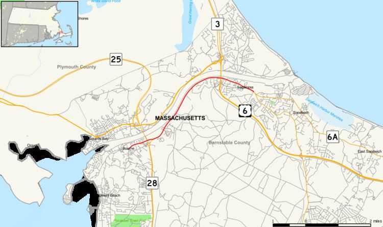
Sandwich Road is a two-lane state highway in Bourne, Massachusetts, United States, running from Bourne center east to Sandwich. It begins at a four-way intersection with Shore Road, County Road and Trowbridge Road in Bourne center; Waterhouse Road and Perry Avenue (the latter the former approach to the old Bourne Bridge) also once ended there. It heads east along the south side of the Cape Cod Canal, passing under both the Bourne Bridge and the Sagamore Bridge. A short connection, also called Sandwich Road, connects the Bourne Rotary - the south end of the Bourne Bridge - with the main road. From the area of the Sagamore Bridge, at Sagamore, east to the Sandwich town line, Sandwich Road carries Route 6A.
Map of Sandwich Rd, Bourne, MA, USA
Sandwich Road once carried both directions of Route 3, which ended at the Bourne Rotary. Later Route 3 was truncated to the Sagamore Rotary, and U.S. Route 6 became a one-way pair at the canal - eastbound on the north side and westbound on the south side (Sandwich Road). The opposite directions were signed as U.S. Route 6 Bypass. Currently both directions of US 6 run north of the canal, and Sandwich Road is an unnumbered state highway. One Bypass US Route 6 shield still remains on EB Sandwich Road.