
Width 4.5 km (2.8 mi) Highest point Veten Elevation 212 m | Length 5 km (3.1 mi) Highest elevation 212 m (696 ft) Area 10.8 km² | |
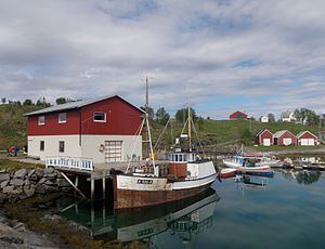 | ||
Sandsøya or Sandsøy is an island in the municipality of Harstad in Troms county, Norway. The island lies east of Grytøya and southeast of Bjarkøya, and has an area of 10.8 square kilometres (4.2 sq mi). The highest point on the island is the 212-metre (696 ft) Veten. In 2001, Sandsøya had 107 inhabitants.
Map of Sands%C3%B8ya, 9425 Sands%C3%B8y, Norway
The island settlement is very old trading post and church village, a part of the former municipality of Bjarkøy. Sandsøy Church is located on the western side of the island in the village of Sandsøy. The other village on the island is Slakstad on the eastern part of the island.
There is a ferry link that runs between Altevik on Sandsøya, Fenes on Grytøya, and Austnes on Bjarkøya. The proposed Bjarkøy Fixed Link will replace the ferry routes and it will link Sandsøya and Grytøya with a bridge and will link Grytøya and Bjarkøya with an undersea tunnel. There is also a connection by the Hurtigruten from Sandsøya to Harstad, Austnes, and Senja. (Route times)