
Trail difficulty Easy Water None | Hills None Length 3,000 m | |
 | ||
Train(s) Flinders Street Station | ||
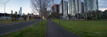
The Sandridge Trail is a shared-use path for cyclists and pedestrians located in the inner southern suburb of Port Melbourne in Melbourne, Victoria, Australia.
Contents
It follows the former Port Melbourne railway line, now the 109 tram route. The trail is also known as the 109 tram trail, which is a misnomer since the tram goes to Box Hill, while the trail only goes to the CBD.
The trail is significant as it follows the path many new immigrants to Australia took when they first entered the country to begin a new life. See also Sandridge Bridge.
As of 2007, the Melbourne Convention Centre area is being developed further. The development is to maintain a link between the Sandridge Trail and Capital City Trail.
Following the path
At Melbourne Exhibition and Convention Centre leave the Capital City Trail by the Yarra River and head south down Clarendon Street to where the Restaurant Trams start their run at Normandy Road. The off road trail starts here and heads west along Normandy Rd soon arriving at the tram corral.
Connections
The Sandridge Trail connects with the Bayside Trail in the west. Heading north leads to West Gate Bridge and the Yarra River punt. Heading south leads to St Kilda. The Capital City Trail is located at the east end and runs into the Melbourne city centre. Cyclists arriving from Tasmania on the Spirit of Tasmania can access the CBD using this path.