
OS grid reference SU1214 Sovereign state United Kingdom | Civil parish Sandleheath Dialling code 01425 | |
 | ||
Population 663 (2001)680 (2011 Census) | ||
Sandleheath is a village and civil parish about 1.8 miles (2.9 km) west of Fordingbridge in the New Forest District of Hampshire, England. It has a population of 663, increasing to 680 at the 2011 Census.
Contents
Map of Sandleheath, Fordingbridge, UK
History
Sandle Manor is an Elizabethan manor house that was extended in 1900 and 1936.
The Church of England parish church of Saint Aldhelm was designed by the architect Charles Ponting and built in 1907.
Economy and amenities
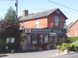
The village has a small area of common land at its centre, a village shop and post office and a small industrial estate. Sandleheath has a Sea Scout group which has a hall in the village.
References
Sandleheath Wikipedia(Text) CC BY-SA