
Country Thailand Time zone THA (UTC+7) Geocode 2408 Population 73,915 (2015) | Seat Khu Yai Mi Postal code 24160 Area 1,666 km² Province Chachoengsao Province | |
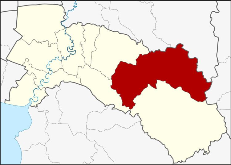 | ||
Sanam chai khet district
Sanam Chai Khet (Thai: สนามชัยเขต) is a district (Amphoe) in the eastern part of Chachoengsao Province, central Thailand.
Contents
- Sanam chai khet district
- Map of Sanam Chai Khet District Chachoengsao 24160 Thailand
- History
- Geography
- Central administration
- Local administration
- References
Map of Sanam Chai Khet District, Chachoengsao 24160, Thailand
History
Mueang Sanam Chai Khet was a city of Ayutthaya kingdom, contemporary with neighboring Mueang Phanat Nikhom and Phanom Sarakham.
Being part of Phanom Sarakham district, on January 6, 1966 the three tambon Khu Yai Mi, Tha Kradan and Tha Takiap were split off to form the minor district (King Amphoe) Sanam Chai (สนามไชย). It was renamed to Sanam Chai Ket on December 14, 1972, and upgraded to a full district on June 28, 1973.
Geography
Neighboring districts are (from the west clockwise) Plaeng Yao, Phanom Sarakham of Chachoengsao Province, Si Maha Phot, Kabin Buri of Prachinburi Province, Khao Chakan of Sa Kaeo Province, Tha Takiap of Chachoengsao Province again and Ko Chan of Chonburi Province.
Central administration
The district Sanam Chai Khet is subdivided into 4 subdistrict (Tambon), which are further subdivided into 70 administrative villages (Muban).
Missing numbers are tambon which now form Tha Takiap.
Local administration
There is one subdistrict municipality (Thesaban Tambon) in the district:
There are 4 subdistrict administrative organizations (SAO) in the district: