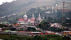
Area 1,019 km² Capital San Ramón, Costa Rica | Founded 21 August 1856 Population 86,312 (Jun 2013) | |
 | ||
Points of interest Arenal Eco Zoo, Butterfly Conservatory, Balneario Las Musas, Museo Histórico José Figu, Desafio Mambo Combo | ||
San Ramón is the second canton in the province of Alajuela in Costa Rica. The canton covers an area of 1,018.64 square kilometres (393.30 sq mi), and has a population of 86,312 (estimate as of 2013).
Contents
Map of Alajuela Province, San Ram%C3%B3n, Costa Rica
The capital city of the canton is also called San Ramón.
Geography
An oddly-shaped canton, San Ramon stretches north through the eastern heights of the Cordillera de Tilarán, looking down on the Central Valley (Valle Central) to its east. The canton forms the border with the province of Guanacaste to the west.
Districts
The canton of San Ramón is subdivided into 13 districts (distritos):
- San Ramón
- Santiago
- San Juan
- Piedades Norte
- Piedades Sur
- San Rafael
- San Isidro
- Los Ángeles
- Alfaro
- Volio
- Concepción
- Zapotal
- Peñas Blancas
History
The canton was established by a decree of August 21, 1856.
References
San Ramón (canton) Wikipedia(Text) CC BY-SA
