
Country Region Mayor Roderick D.G. Tiongson | Area 231.40 km2 District 3rd District | |
 | ||
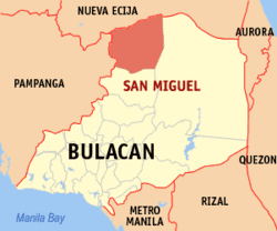
Map of San Miguel, Bulacan
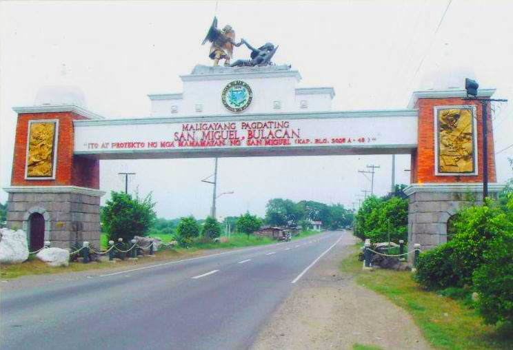
San Miguel, Bulacan (Filipino: Bayan ng San Miguel; Kapampangan: Balen ning San Miguel de Mayumu) is a first class, urban Municipality located in the third district of the Province of Bulacan, Philippines. It is the third largest municipality by area in the province after Doña Remedios Trinidad and Norzagaray. According to the 2015 census, it has a population of 153,882 people.
Contents
- Map of San Miguel Bulacan
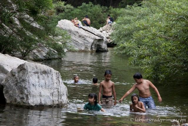
- Ntg 4 na estudyante nalunod sa madlum river sa san miguel bulacan
- Haunted house sa san miguel bulacan binisita ng kapuso mo jessica soho
- History
- The Pact of Biak Na Bato
- Japanese occupation
- Geography
- Climate
- Barangays
- Demographics
- Municipal government
- Education
- Notable people from San Miguel
- From chicharon to ensaymada food trip in bulacan
- References
Ntg 4 na estudyante nalunod sa madlum river sa san miguel bulacan
Haunted house sa san miguel bulacan binisita ng kapuso mo jessica soho
History

The municipality of San Miguel de Mayumo was established in 1763 with Carlos Agustin Maniquiz, Maria Juana Puno - wife of Carlos Agustin Maniquiz and Miguel Pineda as the first town Mayor of San Miguel. Miguel Pineda was a native of Angat, Bulacan who decided to settle permanently in the barrio of San Bartolome (now named Barangay Tartaro). He found the place ideal for hunting and was later chosen as the leader of other settlers. He formed an alliance with Mariano Puno, the recognized leader of the adjacent prosperous village called Sto. Rosario (now named Barangay Mandile). The two leaders decided to form a town named Miguel De Mayumo after the name of Miguel Pineda and Mayumo, a Kapampangan word for sweets, for the goodwill and generosity of Mariano Puno. The town was supposed to be part of Pampanga. San Miguel’s culture drifted from Kapampangan influence. San Miguel used to be the biggest town in Bulacan but when San Ildefonso, Bulacan was proclaimed a town during the 1900s and during the Marcos Regime, he made Doña Remedios Trinidad a town (named after his wife's mother), San Miguel was right as the 2nd.
The Pact of Biak-Na-Bato
During the Philippine Revolution in 1897, newly appointed Governor-General Fernando Primo de Rivera decided to crush Emilio Aguinaldo and his troops in Cavite, but Aguinaldo fled to Batangas and joined forces with Gen. Miguel Malvar. The Spaniards continue their pursuit but the troops outwitted them by going to the province of Morong (now Rizal) and finally to Biak-na-Bato in San Miguel de Mayumo (San Miguel), Bulacan. Aguinaldo made the mountain caves into his headquarters.
On August 26, 2007, residents at the foot of the Biak-na-Bato mountains petitioned president Gloria Macapagal-Arroyo to declare the mountains protected areas to stop marble quarrying and mining there. Biak-na-Bato (21.17 km² in the villages of Kalawakan and Talbak in Doña Remedios Trinidad town and the villages of Biak-na-Bato and Sibul) was one of the camps of the revolutionary Katipunan forces in the 19th century, was declared a national park by Manuel L. Quezon on Nov. 16, 1937 through Proclamation No. 223.
Japanese occupation
Founded during World War II, Japanese Imperial ground troops entered and occupied the town municipality of San Miguel on 1942. Local Filipino troops of the Philippine Commonwealth Army and Philippine Constabulary units retreated into the nearby mountains to become the Bulakeño guerrilla resistance against the Japanese occupation forces until the province's liberation.
Geography
The town of San Miguel is bounded by Nueva Ecija Province in the northernmost area, Pampanga Province in the west, the town is bounded by two provinces with land borders. The town of San Ildefonso, Bulacan lies next to San Miguel in the southernmost area, Doña Remedios Trinidad in the eastmost area which also borders San Rafael and Angat. San Miguel then was the biggest municipality in the province of Bulacan before some areas were taken and annexed to Doña Remedios Trinidad during the term of Ferdinand Marcos. The geographic nature of the town is diversified and multi-faceted, rich in nature's beauty like waterfall, rivers, caves, few mountains, hilly areas and springs. The mainland are plain agricultural lands, some part of which was substantially eroded due to commercialization and urbanization.
Climate
The prevailing climatic conditions in the municipality is categorized into two types: Wet season and dry season.
Barangays
San Miguel is administratively subdivided into 49 barangays. Of these, 11 are considered urban and the rest rural.
Demographics
In the 2015 census, the population of San Miguel, Bulacan, was 153,882 people, with a density of 670 inhabitants per square kilometre or 1,700 inhabitants per square mile.
Municipal government
Municipal Councilors:
- Romeo "Mimio" Dizon
- Richard "Richie" Dela Cruz
- Christopher "Bunso" Beltran
- Bayani "Benny" Tecson
- Ma. Ysabelle Clarisse Anne "MYCA" SM. Bonoan
- Rogelio "Tony" Macasu
- Romy "Excelite" Reyes
- Jayvee Lacsina
ABC President: Rodolfo DG. Dizon
Education
The town has numerous public schools offering elementary and high school education. Some of the elementary public schools are:
Some of the public high schools are:
Some of the private schools offering elementary and pre-elementary education are:
Some of the tertiary schools are: