
Area 125.9 km² Population 6,630 (Jun 2013) | Postal code 20202 Founded 7 August 1868 | |
 | ||
Time zone Central Standard Time (UTC-6) | ||
San Mateo is the fourth canton in the province of Alajuela in Costa Rica. The canton covers an area of 125.90 square kilometres (48.61 sq mi), and has a population of 6,630 (estimate as of 2013).
Contents
Map of Alajuela Province, San Mateo, Costa Rica
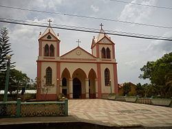
The capital city of the canton is also called San Mateo.
Geography
The northern border of the elongated province is formed by the Río Jesús María, Río Machuca, Río Agua Agría, Río Calera and Quebrada Zapote. The Quebrada Concepción, Río Grande de Tárcoles and the Río Machuca establish the southern border. Cerro La Lana is a landmark that delineates a northeast tip of the canton.
Districts
The canton of San Mateo is subdivided into three districts (distritos):
- San Mateo
- Desmonte
- Jesús María
History
The canton was established by a decree of August 7, 1868.
References
San Mateo (canton) Wikipedia(Text) CC BY-SA