
Area code(s) +57 4 Area 453 km² | Founded August 25, 1875 Elevation 1,050 m Local time Monday 7:51 PM | |
 | ||
Website www.sanluis-antioquia.gov.co/index.shtml Weather 21°C, Wind NW at 6 km/h, 84% Humidity | ||
San Luis is a municipality in Colombia, located in the province of Antioquia. It is limited in the north by the municipalities of San Carlos and Puerto Nare, in the east by the municipality of Puerto Triunfo, in the south by the municipality of San Francisco and in the west by the municipalities of Cocorná and Granada.
Contents
- Map of San Luis San LuC3ADs Antioquia Colombia
- Initial Settlement
- Effects of the Colombian Conflict
- Post Conflict History
- Demography
- Economy
- Ecotourism
- References
Map of San Luis, San Lu%C3%ADs, Antioquia, Colombia
The average temperature in San Luis is 28 Celsius or about 82 Fahrenheit. The municipality is located 124 km from the city of Medellín, the capital of the Antioquia province, and the municipality has an area of 453 km² .
Initial Settlement
Compared to other cities and municipalities in Antioquia, San Luis has a relatively short history. Migration to the region began in 1875 and continued throughout the late 19th century, driven by economic hardship in the region and a spirit of entrepreneurship and colonial expansion that was dominant during the time period. The founder of San Luis is widely considered to be Clemente Giraldo, a Presbyterian priest who sought to create a trading outpost between the cities of Granada and the Río Magdalena.
Upon arriving in the region from Granada with several families, Clemente Giraldo reached a large stone cliff, named "el Castellón" in Spanish, on August 25, 1876, the official founding date of the municipality. Having found a defensible site in the mountains with plenty of forestry and available wood, Giraldo decided that this would be a very suitable site for the outpost. The settlers tested the fertility of the soil by planting banana trees, beans, sugar cane, and yuca and, after a successful harvest, returned to Granada to deliver news regarding the new settlement.
Once news spread of the successful settlement, additional settlers arrived from nearby towns of El Peñol, Marinilla, and El Santuario. By 1878, the town had constructed its first church, a central park and was integrated as a segment of the municipality of San Carlos.
Effects of the Colombian Conflict
Since the 1960s, San Luis suffered a great deal during the Colombian Conflict, especially between 1994 and 2004. The city was frequently targeted by various terrorist and paramilitary organizations, including the FARC, ELN, and Frente IX and was subject to kidnappings, murders, and forced displacements. In 1997 alone there were 255 disappearances, 75 murders, 305 kidnappings and 51,513 displaced persons.
By 1999, the San Luis was an active war zone and many families fled to other parts of the country. The period between 1999 and 2003 included several direct attacks on police and soldiers in the municipality. On December 12, 1999, 300 members of the FARC from the 9th and 47th fronts attacked the city's police station killing 9 policemen and wounding 4. One of the dead was Irma Rosa Gutiérrez, who was 6 months pregnant. On October 9, 2002, the FARC strapped bombs to an 11-year old boy and sent him into the police station in the city's central park. Fortunately, the explosive was detected before it could be exploded.
Post-Conflict History
San Luis has flourished since 2006, both economically and culturally. Argos S.A., Colombia's largest producer of cement, first set up operations in San Luis in 1985, but significantly expanded those operations in 2006, employing more than 500 people and investing more than $700 million US dollars. Since 2015, the city has seen accelerated construction including a new, ongoing investment named Porvenir II, creating a dam, Hydropower plant and lake that is expected to attract even more tourism.
Demography
Economy
The economy of San Luis is agriculture based, heavily based upon fruits, vegetables and livestock and an emphasis harvesting and exportation of wood. The city's exportation of wood is celebrated the last weekend of June each year in the Fiestas de la Madera (Festival of the Wood).
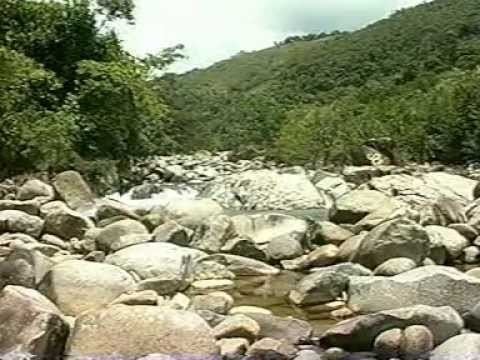
Ecotourism
San Luis is still emerging as a tourist destination, and the tourism industry is focused upon eco-friendly tourism. The municipality has several interesting tourism destinations that are utilized both by visitors and locals alike.