
Elevation 56 m (184 ft) Time zone CET (UTC+1) Postal code 26848 Dialling code 0377 | Demonym(s) Sanfioranesi Area 8.9 km² Local time Saturday 5:19 PM | |
 | ||
Frazioni Campone, Divizia, Lazzaretto, Regone Weather 22°C, Wind SE at 13 km/h, 32% Humidity | ||
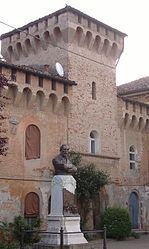
San Fiorano is a comune (municipality) in the Province of Lodi in the Italian region Lombardy, located about 60 kilometres (37 mi) southeast of Milan and about 25 kilometres (16 mi) southeast of Lodi. As of 31 December 2004, it had a population of 1,724 and an area of 8.9 square kilometres (3.4 sq mi).
Map of 26848 San Fiorano Province of Lodi, Italy
The municipality of San Fiorano contains the frazioni (subdivisions, mainly villages and hamlets) Campone, Divizia, Lazzaretto, and Regone.
San Fiorano borders the following municipalities: Codogno, Maleo, Fombio, Santo Stefano Lodigiano.
References
San Fiorano Wikipedia(Text) CC BY-SA