
Elevation 2,600 m (8,500 ft) Area 49.09 km² | City Bogotá D.C. Website Official website Population 404,350 (2007) | |
 | ||
Neighbourhoods ListVeinte de Julio (Bogotá) Time zone Colombia Standard Time (UTC-5) | ||
San Cristóbal, (English: Saint Christopher) is the fourth locality of Bogotá, capital of Colombia. It is located in the south-east of the city.
Contents
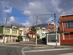
- Map of San CristC3B3bal BogotC3A1 Bogota Colombia
- Borders
- Hydrology
- Topography
- Transportation
- Points of interest
- Neighborhoods
- References
Map of San Crist%C3%B3bal, Bogot%C3%A1, Bogota, Colombia
Borders
North: Santa Fe locality.
South: The locality of Usme.
East: The municipality of Ubaque, Cundinamarca.
West: The localities of Los Mártires and Antonio Nariño.
Hydrology
The Fucha River originates from the Eastern Hills in the east of the locality and is known as the San Cristóbal River while running through the locality's borders.
Topography
Bogotá's southeastern corner, including eastern San Cristóbal, rise into the city's eastern mountain range. The western side of the locality is relatively flat.
Transportation
The main transit artery is Calle 22 south, which is also known as Avenida Primero de Mayo. Other important roads are Calle 11 South, the Eastern Highway which connects the municipalities located to Bogotá's southeast, Carrera 10, and the extension of Avenida Circunvalar in the eastern hills.
Points of interest
Neighborhoods
The neighborhoods of San Cristóbal are:
San Cristóbal, Barcelona, Columnas, Corinto, La Castaña, La Gran Colombia, La María, Montecarlo, Quinta Ramos, San Pedro, Aguas Claras, La Belleza, Buenos Aires, Canadá, El Triángulo, Granada Sur, Juan Rey, La Victoria, Las Mercedes, Los Alpes, Los Libertadores, Malvinas, Nariño Sur, Los Pinares, Quindío, Ramajal, Sagrada Familia, San Blas, San Isidro, San José Sur Oriental, Santa Inés Sur Oriental , Sociego, Suramérica, La Gloria, Veinte de Julio, Villa de los Alpes, Villa Javier, Vitelma.