
Traversed by Road | Elevation 2,066 m | |
 | ||
Similar Alps, Splügen Pass, Gotthard Pass, Lukmanier Pass, Viamala | ||
Porsche 991 gt3 rs san bernardino pass drive
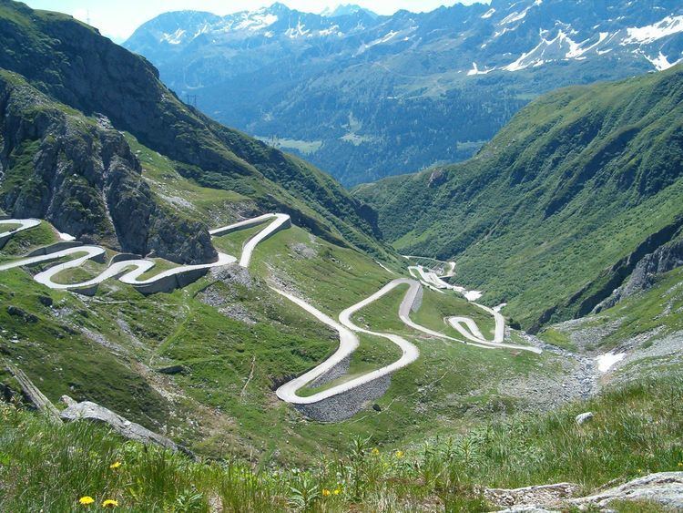
San Bernardino Pass (Italian: Passo del San Bernardino, German: Bernhardinpass, 2,066 metres (6,778 ft)) is a high mountain pass in the Swiss Alps connecting the Hinterrhein and the Mesolcina (Misox) valleys between Thusis (canton of Graubünden) and Bellinzona (canton of Ticino). Located in the far eastern side of the Western Alps it is not to be confused with the Great St Bernard Pass and the Little St Bernard Pass. The top of the pass represents both the Italo-German language frontier and the watershed (drainage divide) between the Po basin and the Rhine basin.
Contents
- Porsche 991 gt3 rs san bernardino pass drive
- Map of San Bernardino Pass 6565 Mesocco Switzerland
- ClimateEdit
- References
Map of San Bernardino Pass, 6565 Mesocco, Switzerland
The route first became important as a mule track in the fifteenth century when the route between Thusis and Splügen was known as the Via Mala. A road for wheeled vehicles was opened in 1770; this road was significantly improved between 1821 and 1823, financed in part by the Kingdom of Sardinia, keen to improve a trade route connecting Genoa and Piedmont to the Graubünden that was not directly controlled by Austria.
Traffic flow was much facilitated when in 1967, the San Bernardino road tunnel was completed, since then vehicle traffic on the pass has been reduced, benefiting those taking the time to avoid the tunnel. The pass road is only open in summer.
The pass is featured in an episode of the BBC television show Top Gear in which the three presenters try to find the best driving road in the world.
ClimateEdit
The average climatic conditions for San Bernardino village at the entry point to the San Bernardino tunnel at 1,639 m (5,377 ft) are given in the following chart.