
Country Spain Island Gran Canaria Postal code 35290 Area 333.1 km² Local time Saturday 1:37 PM Area code 928 | Autonomous Community Canary Islands Time zone CET (UTC+0) Website www.maspalomas.com Population 54,377 (2014) Province Province of Las Palmas Number of airports 1 | |
 | ||
Weather 23°C, Wind E at 24 km/h, 42% Humidity | ||
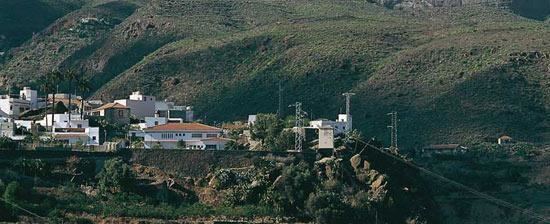
San Bartolomé de Tirajana is a village and a Spanish municipality in the south-eastern part of the island of Gran Canaria in the Las Palmas province in the Canary Islands. With an area of 333.13 km2 (128.62 sq mi), San Bartolomé de Tirajana is the largest municipality in area on the island as well as the Canary Islands. The population is 56,698 (2013).
Contents
Map of 35290 San Bartolom%C3%A9 de Tirajana, Las Palmas, Spain
The municipality contains the large beach resorts of Maspalomas, including Playa del Inglés and San Agustín, and the Pilancones natural park. The municipal capital, the village of San Bartolomé de Tirajana is situated in the mountains, 17 km (11 mi) from the coast and 27 km (17 mi) south-west of Las Palmas, at about 900 m (2,953 ft) elevation. Most of the population lives along the Atlantic coastline. The GC-1 motorway passes through the southern part of the municipality, and connects it with Las Palmas de Gran Canaria and the Gran Canaria Airport.
Education
The British School of Gran Canaria maintains its South Campus in this municipality.
Climate
It is located on the leeward portion of the island. Humid winds cover the northeast in the summer months. Precipitation is lower than the northern part of the island and temperatures are slightly higher than in the north all year round.