
- elevation 800 ft (244 m) Length 30 km | - elevation 0 ft (0 m) | |
 | ||
Similar Bodega Bay, North Salmon Creek Be, Bodega Head, Schoolhouse Beach, Sonoma Coast State Park | ||
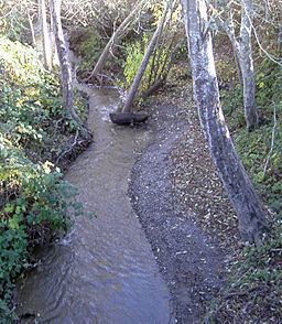
Salmon Creek is an 18.3-mile-long (29.5 km) stream in western Sonoma County, California that springs from coastal hills west of the town of Occidental and empties into the Pacific Ocean north of Bodega Head.
Contents
Map of Salmon Creek, California, USA
CourseEdit
Salmon Creek originates about 2 miles (3 km) west of the town of Occidental near the junction of Joy Road and Bittner Road. It parallels Bittner Road eastward, passing just south of Occidental, where it turns right and follows Bohemian Highway to the town of Freestone. From there, it curves south and then west, passing Watson School historic park as it parallels Bodega Highway to a confluence with Nolan Creek just east of the town of Bodega. It flows through Bodega, then follows Salmon Creek Road westward into a narrow canyon, where it is joined by Tannery Creek, Fay Creek, Coleman Valley Creek, and Finley Creek. Salmon Creek emerges from the canyon between Irish Hill and Coleman Hill and crosses State Route 1 at milepost 12.49, entering Sonoma Coast State Beach south of the ranger station. It parallels Bean Road to Salmon Creek Beach, which it bisects as it enters the Pacific Ocean.
HistoryEdit
When European explorers first reached Salmon Creek, they found it inhabited by Coast Miwok people. Six Coast Miwok villages near the creek have been authenticated: Pulya-lakum, near the mouth of the creek, Kennekono and Suwutenne near the present-day town of Bodega, and three near the present day town of Freestone: Oye-yomi, Pakahuwe, and Patawa-yomi.
In 1843-44, most of the Salmon Creek watershed was included in the 35,000-acre (140 km2) Rancho Bodega land grant awarded to Captain Stephen Smith.
In 1873, the North Pacific Coast Railroad built a narrow-gauge line along the stretch of Salmon Creek between Freestone and Occidental as part of the route from Sausalito to Cazadero.
EcologyEdit
As of 2000, Salmon Creek and its five named tributaries all supported steelhead trout (Oncorhyncus mykiss). Salmon Creek also harbored California freshwater shrimp (Syncaris pacifica), and coho salmon (Oncorhyncus kisutch) were known to inhabit both Salmon Creek and Tannery Creek. By 2006, however, the salmon run had ceased. On July 2, 2010 the Salmon Creek Water Conservation Plan was released with important recommendations for restoring dry season instream flows, which have been exacerbated primarily by man-made water diversions. The Plan included such innovative solutions such as rooftop water harvesting and re-introduction of Golden Beaver. The historic presence of beaver was evident in the first Russian-American Company voyage by Ivan Kuskov who sailed into Bodega Bay in 1809 on the Kodiak and returned to Novo Arkhangelsk, Alaska (Sitka), with beaver skins and over 2,000 sea otter pelts. French naval captain Cyrille Laplace visited the Russian farms with the Aleksandr Rotchev, the last manager of Fort Ross, in 1839. After spending time at the Chernykh farm (near Graton probably on Purrington Creek) they rode to the Kirill Timofeevich Khlebnikov farm (near Bodega Corners) on Salmon Creek and wrote, "we had stopped a moment by a little river on the banks of which my traveling companion pointed out to me the former habitations of beaver, probably destroyed by the Indians in order to catch the rich prize that lay within." In 2009 and 2010 the California Department of Fish and Game have re-introduced coho salmon into Salmon Creek.
It is also the only extant location of the nearly extinct Baker's larkspur.
BridgesEdit
At least seven bridges span Salmon Creek. The newest and longest of these is the State Route 1 bridge, which is 200 feet (61 m) long and was built in 1983. Freestone Flat Road crosses on a steel truss 103 feet (31 m) long which was built in 1955, making it the oldest of the seven. Bodega Highway crosses in two places: 0.9 miles (1.4 km) from State Route 1 on a bridge 92 feet (28 m) long built in 1962 and at Valley Ford-Freestone Road on a 76 ft (23 m) bridge built in 1968. Salmon Creek Road spans the creek on a 78 ft (24 m) bridge dating from 1958, Bohemian Highway crosses on a 70 ft (21 m) bridge from 1971, and Scouts Camp Road crosses on a 57 ft (17 m) structure from 1960.