
Country Canada TE Kativik Time zone EST (UTC−5) Area 14.7 km² Province Québec Area code 819 | Region Nord-du-Québec Constituted December 29, 1979 Postal code(s) J0M 1S0 Population 1,347 (2011) Local time Wednesday 11:41 AM Number of airports 1 | |
 | ||
Weather -14°C, Wind W at 14 km/h, 61% Humidity | ||
Northern canada day 6 salluit quebec le nord canadien jour 6 salluit qu bec
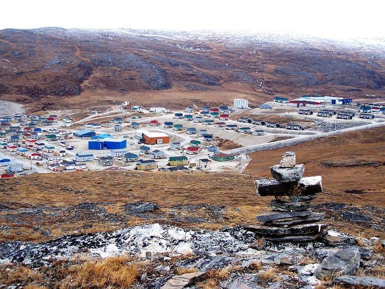
Salluit (Inuktitut: ᓴᓪᓗᐃᑦ is the second northernmost Inuit community in Quebec, Canada, located on Sugluk Inlet close to the Hudson Strait and was formerly known as Sugluk. Its population was 1,347 in the Canada 2011 Census, and growing rapidly. It is not accessible by road, but by air through Salluit Airport.
Contents
- Northern canada day 6 salluit quebec le nord canadien jour 6 salluit qu bec
- Map of Salluit QC Canada
- Landing in salluit qc cyzg dash 8 100
- History
- Notable residents
- References
Map of Salluit, QC, Canada
Salluit means "The Thin Ones" in Inuktitut, referring to a time when local inhabitants were facing starvation as a result of a lack of wildlife.
Landing in salluit qc cyzg dash 8 100
History
In 1925, an independent trader opened a trading post on the site of present-day Salluit. Not to be outdone, the Hudson's Bay Company (HBC) quickly established its own post on the far shore of Sugluk Inlet but relocated it soon after to Deception Bay, about 53.5 km (33.2 mi) to the east. In 1930, the HBC built a store at present-day Salluit and closed its post at Deception Bay in 1932. The golden years of fur trading came to an end around 1936 when the price of pelts collapsed.
In 1930 a Catholic mission was established, closing some twenty years later, but followed by an Anglican mission in 1955. The Government of Canada opened a day school in 1957. As more public services were being delivered, Inuit settled around the small village. The first residential houses were built in 1959 and ten years later a co-operative store was established by its residents. Salluit legally became a municipality in 1979.