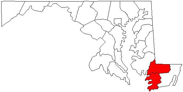
The Salisbury Metropolitan Statistical Area, as defined by the United States Census Bureau in 2010, is a metropolitan area centered on the city of Salisbury, Maryland and including portions of the U.S. states of Delaware and Maryland on the Delmarva Peninsula. The metropolitan area consists of four counties: Somerset, Wicomico, and Worcester in Maryland and Sussex in Delaware.
Somerset County, MarylandWicomico County, MarylandWorcester County, MarylandSussex County, DelawareSalisbury, Maryland (Principal City)Georgetown, DelawareMilford, Delaware (part)Ocean City, MarylandOcean Pines, Maryland (census-designated place)Seaford, DelawareBerlin, MarylandBethany Beach, DelawareBlades, DelawareBridgeville, DelawareCrisfield, MarylandDelmar, DelawareDelmar, MarylandFruitland, MarylandLaurel, DelawareLewes, DelawareLong Neck, Delaware (census-designated place)Millsboro, DelawareMilton, DelawareOcean View, DelawarePittsville, MarylandPocomoke City, MarylandPrincess Anne, MarylandRehoboth Beach, DelawareSelbyville, DelawareSnow Hill, MarylandWest Ocean City, Maryland (census-designated place)Dagsboro, DelawareDeal Island, Maryland (census-designated place)Eden, Maryland (census-designated place)Fairmount, Maryland (census-designated place)Frankford, DelawareGreenwood, DelawareHebron, MarylandMillville, DelawareMount Vernon, Maryland (census-designated place)Sharptown, MarylandWillards, MarylandAllen, Maryland (census-designated place)Bethel, DelawareBishopville, Maryland (census-designated place)Bivalve, Maryland (census-designated place)Chance, Maryland (census-designated place)Dames Quarter, Maryland (census-designated place)Dewey Beach, DelawareEllendale, DelawareFenwick Island, DelawareFrenchtown-Rumbly, Maryland (census-designated place)Girdletree, Maryland (census-designated place)Henlopen Acres, DelawareJesterville, Maryland (census-designated place)Mardela Springs, MarylandNanticoke, Maryland (census-designated place)Nanticoke Acres, Maryland (census-designated place)Newark, Maryland (census-designated place)Parsonsburg, Maryland (census-designated place)Powellville, Maryland (census-designated place)Quantico, Maryland (census-designated place)Slaughter Beach, DelawareSmith Island, Maryland (census-designated place)South Bethany, DelawareStockton, Maryland (census-designated place)Tyaskin, Maryland (census-designated place)Waterview, Maryland (census-designated place)West Pocomoke, Maryland (census-designated place)Whaleyville, Maryland (census-designated place)Whitehaven, Maryland (census-designated place)Prior to the 2010 Census, the Salisbury metropolitan area consisted only of Wicomico and Somerset counties in Maryland. As of the 2000 census, the MSA had a population of 109,391 (though a July 1, 2009 estimate placed the population at 120,181). Worcester County, Maryland was considered a part of the Ocean Pines Micropolitan Statistical Area and Sussex County, Delaware was considered a part of the Seaford Micropolitan Statistical Area.
The Salisbury–Ocean Pines Combined Statistical Area consisted of the Salisbury metropolitan area and the Ocean Pines micropolitan area. As of the 2000 Census, the CSA had a population of 155,934 (though a July 1, 2009 estimate placed the population at 169,303).
As of the census of 2000, there were 109,931 people, 40,579 households, and 27,223 families residing within the MSA. The racial makeup of the MSA was 68.92% White, 27.32% African American, 0.25% Native American, 1.46% Asian, 0.02% Pacific Islander, 0.73% from other races, and 1.30% from two or more races. Hispanic or Latino of any race were 1.99% of the population.
The median income for a household in the MSA was $34,469, and the median income for a family was $42,386. Males had a median income of $29,989 versus $23,292 for females. The per capita income for the MSA was $17,568.
US 9 US 13 US 50 US 113 DE 1 DE 16 DE 20 DE 24 DE 26 DE / MD 54 DE 404 MD 12 MD 90 MD 313 MD 413 MD 528Salisbury–Ocean City–Wicomico Regional AirportBennett AirportCrisfield Municipal AirportDelaware Coastal AirportLaurel AirportOcean City Municipal AirportShore Transit - Serves Somerset, Wicomico, and Worcester counties with local routes in Salisbury and commuter routes between cities and towns in the three counties.DART First State - Serves Sussex County, Delaware with six year-round routes along with seasonal routes in the beach communities and inter-county service to other parts of Delaware.Ocean City Beach Bus - Bus service in Ocean City with connections to Shore Transit and DART First State.Colleges and universities
Delaware Technical Community College Jack F. Owens CampusSalisbury UniversitySojourner–Douglass College Salisbury CampusUniversity of Maryland Eastern ShoreWor–Wic Community College