
Canton Salazie INSEE/Postal code 97421 /97433 Population 7,065 (2006) | Area 103.8 km² Local time Wednesday 1:38 PM | |
 | ||
Elevation 230–3,071 m (755–10,075 ft)(avg. 446 m or 1,463 ft) Weather 25°C, Wind E at 11 km/h, 79% Humidity Points of interest Piton des Neiges, Trou de Fer, Bridal Veil Falls, Maison Folio, Rivière du Mât | ||
Salazie isla re union
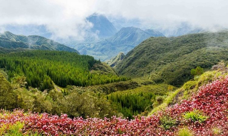
Salazie is a volcanic caldera and commune (administrative division) in the department and region of Réunion.
Contents
- Salazie isla re union
- Map of Salazie Reunion
- Canyoning trou blanc cirque de salazie
- Geography
- References
Map of Salazie, Reunion
The first settlement of the area took place in 1829 after a cyclone had devastated the nearby coast, and the municipality of Salazie was formed in 1889. The name of the commune is potentially derived from the Malagasy word salazy, meaning 'good encampment'.
Canyoning trou blanc cirque de salazie
Geography
Salazie lies in the middle of island, north-east of Piton des Neiges (the highest point on the island), in the Cirque de Salazie (actually a volcanic caldera). The commune is totally landlocked, and borders the communes of Bras-Panon, Cilaos, La Possession, Saint-André, Saint-Benoît, Saint-Denis, Sainte-Marie and Sainte-Suzanne.
References
Salazie Wikipedia(Text) CC BY-SA