
Country North Korea Local time Wednesday 2:10 PM | Area 2,807 km² Province North Pyongan | |
 | ||
Administrative divisions 1 ŭp, 6 workers' districts, 18 ri Weather 13°C, Wind SW at 27 km/h, 36% Humidity | ||
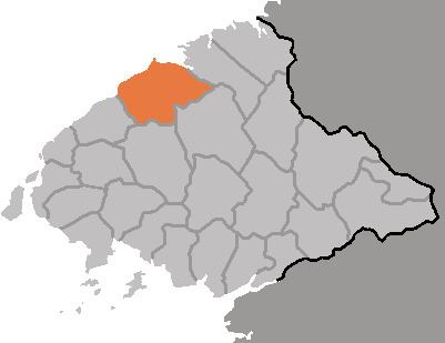
Sakchu County is a kun, or county, in northern North P'yŏngan province, North Korea. It lies on the Yalu River, bordering the People's Republic of China to the north. Within North Korea, it borders Ch'angsŏng to the east, Ch'ŏnma and Taegwan to the south, and Ŭiju to the west.
Contents
Geography
The Kangnam Mountains rise in the southeast of Sakchu. The highest peak is Munsan, at 1046 m. The terrain overall is rugged, with only 13% of the county's area under cultivation, as compared to 80% which is forested.
Administrative Divisions
Sakchu county is divided into 1 ŭp (town), 6 rodongjagu (workers' districts) and 18 ri (villages):
Climate
The year-round average temperature is 8.1 °C, with an average of -10.1 °C in January and 23.4 °C in August.
Economy
Livestock farming is important to the local economy; Sakchu leads the province in the number of hogs raised. Other local crops include rice, soybeans, sweet potatoes, gochu peppers, and fruit. In addition, there is a large hydroelectric power station on the Yalu at Sup'ung Dam.
Transportation
The P'yŏngbuk Line of the Korean State Railway passes through the county, on its way between Chŏngju and Ch'ŏngsu (청수). The Yalu is also used for passenger and freight traffic.
Education
There are eight colleges in Sakchu. These include Supung Industrial College, Sakchu Industrial College, and Supung Specialized College of Electricity (수풍전기단과대학).
Military
Under the control of the Thirty-second Division, some of North Korea's chemical weapons factories are located in the city.