
Area 12.89 km² Flower Sage | Local time Wednesday 2:00 PM | |
 | ||
Weather 15°C, Wind SW at 11 km/h, 52% Humidity University | ||
Sakahogi (坂祝町, Sakahogi-chō) is a town located in Kamo District, Gifu Prefecture, Japan.
Contents
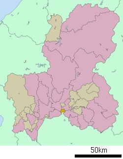
Map of Sakahogi, Kamo District, Gifu Prefecture, Japan
As of July 2011, the town has an estimated population of 8,443. The total area is 12.89 km². The town was formed in 1968.
History
Sakahogi was formed on October 1, 1968 when the village of Sakahogi (坂祝村, Sakahogi-mura) gained town status. The village of Sakahogi was formed on April 1, 1897 by a merger of the villages of Sakakura, Torikumi, Ōhari, Kuroiwa, Fukagaya, Katsuyama and Fukada, and got its name from Sakahogi shrine. In 1950 the Fukada part of Sakahogi was merged into the town of Ōta, now a part of Minokamo.
Education
Railroad
References
Sakahogi, Gifu Wikipedia(Text) CC BY-SA