
Area 18.55 km² Local time Wednesday 1:59 PM | Region Kantō Population 124,845 (Feb 2010) | |
 | ||
Address 303-19 Katsura-chō, Sakae-ku Yokohama-shi, Kanagawa-ken247-0005 Weather 14°C, Wind SE at 14 km/h, 60% Humidity Points of interest Earth citizen Kanagaw, Taya caves, Kanai Park, Jōsen‑ji Temple, Kosugayakita Park | ||
Sakae-ku (栄区) is one of the 18 wards of the city of Yokohama in Kanagawa Prefecture, Japan. As of 2010, the ward had an estimated population of 124,845 and a density of 6,750 persons per km². The total area was 18.55 km².
Contents
- Map of Sakae Ward Yokohama Kanagawa Prefecture Japan
- Geography
- Surrounding municipalities
- History
- Economy
- Railroads
- Highways
- Noted people from Sakae Ward
- References
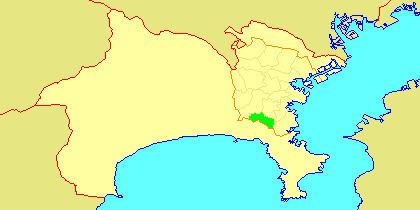
Map of Sakae Ward, Yokohama, Kanagawa Prefecture, Japan
Geography
Sakae Ward is located in eastern Kanagawa Prefecture, and on the southwestern borders of the city of Yokohama. The area is largely flatland, with scattered small hills.
Surrounding municipalities
History
The area around present-day Sakae Ward has been inhabited continuously for thousands of years. Archaeologists have found stone tools from the Japanese Paleolithic period and ceramic shards from the Jomon period, house ruins from the Yayoi period and tombs from the Kofun period at numerous locations in the area. Under the Nara period Ritsuryō system, it became part of Kamakura District in Sagami Province. By the Kamakura period, much of the area was farmland supporting the population of nearby Kamakura. Most of the area came under the control of the Nagao clan, the ancestors of the Uesugi clan. During the Edo period, the territory came under the control of Tokugawa Ieyasu. It was administered as tenryō territory controlled directly by the Tokugawa shogunate, but administered through various hatamoto.
After the Meiji Restoration, Sakae became part of the new Kanagawa Prefecture in 1868. In the cadastral reform of April 1, 1889, the area was divided into Hongo, Sakae and Toyota villages under Kamakura District. In 1938, the Imperial Japanese Navy established a large fuel depot in former Hongo Village. On April 1, 1939, Sakae was annexed by the neighboring city of Yokohama, becoming part of Totsuka Ward. In the post-war period, parts of Sakae were used as a residential area for the American occupation forces. All American facilities were returned to Japan by 1967. In a major administrative reorganization of October 1, 1969, Totsuka-ku was divided, and Sakae emerged as an independent ward within the city of Yokohama.
Economy
Sakae Ward is largely a regional commercial center and bedroom community for central Yokohama and Tokyo. There are a number of industries, including factories operated by Nikon, Fancl, Sumitomo Electric Industries and Shibaura Mecatronics.