
Country Canada Incorporated May 12, 1986 Postal code(s) E8T Area 15.61 km² Local time Wednesday 12:05 AM Area code 506 | Time zone AST (UTC-4) Highways Route 305 Population 955 (2011) Parish Shippagan | |
 | ||
Weather -2°C, Wind E at 14 km/h, 92% Humidity | ||
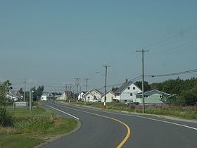
Sainte-Marie-Saint-Raphaël (2011 pop.: 955) is a Canadian village in Gloucester County, New Brunswick; its name is sometimes abbreviated Ste-Marie-St-Raphaël.
Contents
Map of Sainte-Marie - Saint-Rapha%C3%ABl, NB, Canada
Located on Lamèque Island, the village was formed by the incorporation of most of the local service district of St. Raphael sur-Mer and a small part of the neighbouring LSD of Haut-Lamèque. Contrary to frequent citation, it was not formed by an amalgamation involving a village called Sainte-Marie.
History
In May 1971, an anxious Acadian fishing population demanded a public hearing into the safety of the Marc Guylaine, and 400 people met at the Saint-Raphaël community centre where an "action group" was commissioned to study the issue. Ultimately the last of the "cursed" sister ships was found to be unseaworthy.