
Intercommunality Trois Vallées Area 238 ha Population 35 (1999) | Time zone CET (UTC+1) Local time Wednesday 2:59 AM | |
 | ||
Weather 8°C, Wind NE at 6 km/h, 83% Humidity | ||
Saint-Sulpice-de-Ruffec is a commune in the Charente department in southwestern France. It is the least populated commune of Charente.
Contents
Map of Saint-Sulpice-de-Ruffec, France
Geography
The commune is situated in the valley of the river Tiarde. The northwest of the commune of Saint-Sulpice-de-Ruffec is watered by the Tiarde; the remaining land includes the valley's high plateau.
The village of Saint Sulpice consists of a collection of houses grouped around the church and overlooking the valley of the Tiarde and a collection of small hamlets: Le Roule at the edge of the town of Couture, les Fantins near Route of Champagne-Mouton-Chenon in the south of the commune, les Raffoux, Chez Bahuet near to the Tiarde, etc.
The commune of Saint-Sulpice-de-Ruffec is 10 miles southeast of Ruffec, there is one main road running through the commune the Aunac to Champagne-Mouton road
The soil is predominately clay.
Population
The population of Saint-Sulpice-de-Ruffec is now a mix of French nationals and British.
Economy
Agricultural: bovine and crops mainly maize, oil seed rape and sunflowers, diversification into raising of Alpaca s, for wool and breeding
Sights
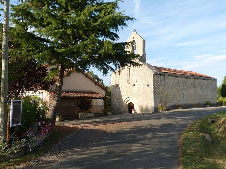
The village of Saint-Sulpice is centred on its 12th-century church. Directly outside the church is a war memorial dedicated to eight people who lost their lives in the first world war (1914–1918).
On the outskirts of the commune of Saint-Sulpice-de-Ruffec, there is a memorial to a French patriot Largeau Gilbert who was shot on 26 June 1944.