Kalpana Kalpana (Editor)

Saint Saviour, Jersey

Updated on
Edit
Like
Comment
Share on FacebookTweet on TwitterShare on LinkedInShare on Reddit
Area rank
  
Ranked 8th

Postcode district
  
JE2

Area
  
9.3 km²

Time zone
  
GMT

Postcode sector
  
7

Population
  
13,580 (2011)

Saint Saviour, Jersey httpsuploadwikimediaorgwikipediacommonsthu

Crown Dependency
  
Jersey, Channel Islands

Saint Saviour (Jèrriais: St Saûveux/St Sauveur) is one of the twelve parishes of Jersey in the Channel Islands.

Contents

Map of St Saviour, Jersey

It has a land surface area of 3.6 square miles (9.3 km2), borders with five other parishes, and has a very small coastline at Le Dicq.

Vingtaines

The parish is divided into vingtaines for administrative purposes as follows:

  • La Vingtaine de Maufant
  • La Vingtaine de Sous la Hougue
  • La Vingtaine des Pigneaux
  • La Vingtaine de la Grande Longueville
  • La Vingtaine de la Petite Longueville
  • La Vingtaine de Sous l'Église
  • For electoral purposes the parish is divided into three districts:

  • District No. 1 (Vingtaine de la Petite Longueville) elects two Deputies
  • District No. 2 (Vingtaine de Sous l'Église) elects two Deputies
  • District No. 3 (Vingtaines de Maufant, de Sous la Hougue, des Pigneaux and de la Grande Longueville) elects one Deputy
  • Demographics

    Saint Saviour is Jersey's second most populated parish, with 13,580 residents in 2011.
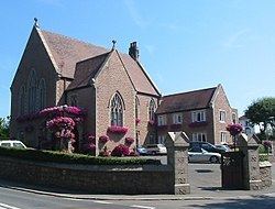
    Notable sites

  • Government House
  • Highlands College
  • De La Salle College
  • St. Michael's Preparatory School
  • Jersey College for Girls
  • Hautlieu School
  • Grainville Cricket Ground
  • Grainville School
  • Jersey Evening Post offices and printing works
  • References

    Saint Saviour, Jersey Wikipedia