
Time zone EST (UTC−5) Area code(s) 418 and 581 Area 61.9 km² Local time Tuesday 9:09 PM | Constituted April 11, 1890 Postal code(s) G0X 2B0 Population 860 (2011) Province Québec | |
 | ||
Weather 2°C, Wind N at 6 km/h, 94% Humidity | ||
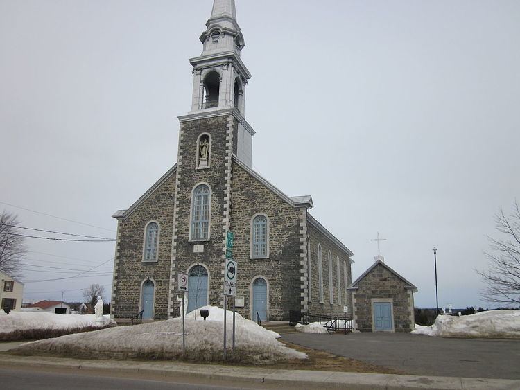
Saint-Séverin (also called St-Séverin-de-Proulxville or simply Proulxville) is a parish municipality in Quebec (Canada) in the Mékinac Regional County Municipality, Quebec, in the administrative region of Mauricie and watershed the Batiscanie. At various times, the place was also known as Saint-Séverin-de-Proulxville and Proulxville.
Contents
- Map of Saint SC3A9verin QC Canada
- Demographics
- Religious chronology
- Municipal chronology
- Railroad
- Toponymy
- Geography
- Rivire des Envies
- Rivire la Tortue Turtle River
- References
Map of Saint-S%C3%A9verin, QC, Canada
Historically its economy was based mainly on agriculture. Until the mid-20th century, farmers were actively involved in the supply of lumber camps of the Middle and Upper Mauricie, providing men, horses, carriages, meat, flour, fodder, household items ... Two flour mills with a regional upstream of the village contributed significantly to the regional economy.
Demographics
Population trend:
Private dwellings occupied by usual residents: 378 (total dwellings: 394)
Mother tongue:
Religious chronology
According to the conventions of the time, the canonical erection of the parish preceded the civil erection. Prior to 1889, the territory was inhabited and experienced intensive clearing. The Pioneers enjoyed the services of religion at the village of Saint-Stanislas or Saint-Tite. The remoteness of the pioneers made it difficult to practice faith and access to shops and public services in Saint-Tite or Saint-Stanislas. In winter, the pioneers used the ice road over the River des Envies; in other seasons, the roads were bad, especially because of the rain, spring floods and culverts improvised in fund flows. By 1873, the sector's pioneers have made several representations to the Bishop of Trois-Rivières requesting their own parish.
Note that the hamlet Cossetteville (located at the southern end of the Grand Rang Saint-Tite) grew and was popularly regarded as a potential site for a new village for the sector. Religious authorities of the diocese of Trois-Rivières took into consideration the distance between Saint-Stanislas, Saint-Narcisse and Saint-Tite, to facilitate access to the religion.
Municipal chronology
Railroad
A railroad section was built to link Saint-Stanislas and Hérouxville. This railroad section started at the Transcontinental stood (east side of Batiscan River) in front of the village of Saint-Stanislas, crossed the river on an iron bridge (located upstream of the village), then roamed the southern part of the municipality of Saint-Séverin, and reached the discharge of Lac-à-la-Tortue (located in Hérouxville). There, the railroad did a big curve of around 90 degrees (in north-west direction) in order to follow the path of chemin de la Grande Ligne (Great line). Finally this railroad section joined (about 1 km west of the village of Hérouxville) the railway line connecting the junction Garneau to Hervey-Junction.
The railway station of Saint-Séverin was located on the "road of Cote Saint-Paul," about 300 meters from the intersection of Côte Saint-Paul. The distance by road between the church of Saint-Severin and its station was about 4.1 km.
Toponymy
The town of Saint-Séverin is named in honor of the vicar-general Louis Severin Rheault and abbot Severin of Saint-Maurice-en-Valais. Proulxville name is in memory of Father Prudent Proulx (1853-1924), the first parish priest (1889-1918).
Geography
The main street of Saint-Séverin is called "Boulevard Saint-Louis", which is the continuation of the path "Côte Saint-Louis" which crosses the municipality in a straight line from north to south, from the "Rivière des Envies". The way "Côte Saint-Louis" ends at the intersection of Route 352 in Saint-Stanislas, about 800 meters south of the discharge of "rivière des Envies". [[Fichier:Bordeleau bridge on Rivière-des-Envies.JPG|thumb|left|Bordeleau bridge, Saint-Séverin (Mékinac), Quebec.]] Covered Bridge (formerly named "Bordeleau Bridge") spans the "Rivière des Envies", at the boundary of Saint-Tite, Hérouxville and Saint-Séverin. The first bridge was built in 1875 and was rebuilt in 1932 with a roof. This bridge is located on the Dessureault road connecting to the Grand Rang Saint-Tite (in the hamlet of Cossetteville).
The municipality of Saint-Séverin of Proulxville is enclosed by Saint-Tite (North West), Saint-Adelphe (northeast), Saint-Stanislas (southeast), Saint-Narcisse (south) and Hérouxville (west). The distance between the church of Saint-Séverin and the surrounding parishes are: Saint-Narcisse (17.3 km path through the Côte Saint-Paul, and road of row Saint-Pierre), Saint-Stanislas (12.7 km via the Saint-Louis road), Saint-Adelphe (16.8 km via the St-Émile road) and Saint-Tite (9 km through Grand Rang road).
"Rivière des Envies" and its tributary the "Rivière à la tortue" (Turtle River) are the two significant rivers that have marked the geography of the "Saint-Séverin" parish.
Rivière des Envies
Coming from the north-west (Saint-Tite), the "Rivière des Envies" makes a long curve before empties in the fall at the former two mills: sawmill and floormill. Then, the river goes to the village of Saint-Séverin, pass a big drop at the downstream end of the village. The river continues its course and pass under the bridge path Trefflé Veillette, then crosses the municipality of Saint-Stanislas to pour into "Batiscan River" at the southern boundary of the village. At the height of Proulxville, "Rivière des Envies" is bordered by a road on each side: the path of the Rivière des Envies North East and Rivière des Envies Southeast. In winter, the "Rivière des Envies" ice road connected Saint-Stanislas and Saint-Tite. This iced road was used with heavily loaded sleighs in the intention to avoid the calvettes on parallel roads and slopes, which were complicated to cross.
Rivière à la Tortue (Turtle River)
The "Rivière à la Tortue" (Turtle river) begins at the outlet of "lac-à-la-tortue" (Turtle Lake) (Hérouxville sector), runs north-east crossing the "Chemin de la Grande Ligne" (Great line road) and "Chemin (road) Saint-Pierre". Then, Turtle River makes a curve to the right to browse the municipality of Saint-Sévérin de Proulxville, more or less in parallel to the "Rivière des Envies". Turtle River cuts the path of Côte Saint-Paul road about 3.2 km southeast of the intersection of the road of the Côte Saint-Louis. Then the river cuts the Saint-Louis Road about 0.6 miles from the intersection of Route 159. Then the river goes to Saint-Stanislas, where it empties into the Rivière des Envies, near the bridge of route 159.