
Intercommunality Pays Thibérien Area 19.85 km² | Canton Thiviers Population (2006) 453 Local time Wednesday 1:29 AM | |
 | ||
Weather 11°C, Wind NE at 10 km/h, 75% Humidity | ||
Saint-Pierre-de-Côle is a commune in the Dordogne department in Nouvelle-Aquitaine in southwestern France.
Contents
Map of 24800 Saint-Pierre-de-C%C3%B4le, France
Geography
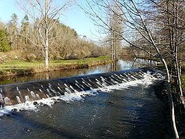
The River Côle flows southwestward through the middle of the commune, crosses the village and forms part of the commune's south-western border. The village straddles the D 78 road from Brantome to St. Jean de Cole. At the centre of the village is the village square with an ancient Romanesque church which has been heavily restored and the cafe/restaurant 'La Marmite'. There is also a post office and a bakery in the village.
The village festival takes place on the first weekend in August, and there are fireworks on the river.
References
Saint-Pierre-de-Côle Wikipedia(Text) CC BY-SA