Time zone CET (UTC+1) Population 1,966 (2007) Arrondissement Perpignan | Region Occitanie Intercommunality Agly Fenouillèdes Area 43.9 km² Local time Wednesday 1:08 AM | |
 | ||
Canton Saint-Paul-de-Fenouillet Weather 11°C, Wind W at 11 km/h, 67% Humidity Points of interest Gorge De Galamus, Ermitage Saint‑Antoine de Galam, Mas Peyre Fils Et Fille, Domaine D'Esperet | ||
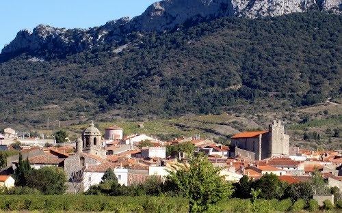
Saint-Paul-de-Fenouillet (Occitan: Sant Pau de Fenolhet) is a commune in the Pyrénées-Orientales department in southern France.
Contents
- Map of 66220 Saint Paul de Fenouillet France
- Geography
- International relations
- Sites of interest
- Coat of arms
- References
Map of 66220 Saint-Paul-de-Fenouillet, France
Geography
Saint-Paul-de-Fenouillet is located in the canton of Saint-Paul-de-Fenouillet and in the arrondissement of Perpignan.
International relations
Saint-Paul-de-Fenouillet is twinned with the town of Ennis in the Republic of Ireland.
Sites of interest
Coat of arms
It is said that the Coat of Arms has a relationship with Jean Lannes, 1st Duc de Montebello, 1st Prince de Siewierz (10 April 1769 – 31 May 1809) and Marshal of the Empire whose coat of arms has the sword pointing up, in recognition for his relationship with Marie Antoinette and Marius Fenouillet during the First Empire.
References
Saint-Paul-de-Fenouillet Wikipedia(Text) CC BY-SA
