
- elevation 74.7 m (245 ft) Length 1,197 km Source Lake Ontario Provinces Ontario, Québec | - elevation 0 m (0 ft) Area 1.344 million km² Islands Croil Island | |
 | ||
- location Kingston, Ontario / Cape Vincent, New York - average 16,800 m/s (590,000 cu ft/s) Mouths Gulf of Saint Lawrence, Atlantic Ocean Bridges Jacques Cartier Bridge, Champlain Bridge | ||
1000 islands st lawrence river canada usa
The Saint Lawrence River (French: Fleuve Saint-Laurent; Tuscarora: Kahnawáʼkye; Mohawk: Kaniatarowanenneh, meaning "big waterway") is a large river in the middle latitudes of North America. The Saint Lawrence River flows in a roughly north-easterly direction, connecting the Great Lakes with the Atlantic Ocean and forming the primary drainage outflow of the Great Lakes Basin. It traverses the Canadian provinces of Quebec and Ontario, and is part of the international boundary between Ontario, Canada, and the U.S. state of New York. This river also provides the basis of the commercial Saint Lawrence Seaway.
Contents
- 1000 islands st lawrence river canada usa
- Map of St Lawrence River
- Geography
- History
- Resident whales
- Works
- References
Map of St Lawrence River
Geography
The St. Lawrence River begins at the outflow of Lake Ontario and flows through Gananoque, Brockville, Morristown, Ogdensburg, Massena, Cornwall, Montreal, Trois-Rivières, and Quebec City before draining into the Gulf of Saint Lawrence, the largest estuary in the world. The estuary begins at the eastern tip of Île d'Orléans, just downstream from Quebec City. The river becomes tidal around Quebec City.
The St. Lawrence River runs 3,058 kilometres (1,900 mi) from the farthest headwater to the mouth and 1,197 km (743.8 mi) from the outflow of Lake Ontario. The farthest headwater is the North River in the Mesabi Range at Hibbing, Minnesota. Its drainage area, which includes the Great Lakes, the world's largest system of freshwater lakes, is 1,344,200 square kilometres (518,998.5 sq mi), of which 839,200 km2 (324,016.9 sq mi) is in Canada and 505,000 km2 (194,981.6 sq mi) is in the United States. The basin covers parts of Ontario and Quebec in Canada, parts of Illinois, Indiana, Minnesota, New York, Ohio, Pennsylvania, Vermont, and Wisconsin, and the entirety of the state of Michigan in the United States. The average discharge below the Saguenay River is 16,800 cubic metres per second (590,000 cu ft/s). At Quebec City, it is 12,101 m3/s (427,300 cu ft/s). The average discharge at the river's source, the outflow of Lake Ontario, is 7,410 m3/s (262,000 cu ft/s).
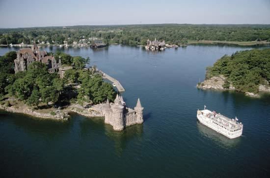
The St. Lawrence River includes Lake Saint-Louis south of Montreal, Lake Saint Francis at Salaberry-de-Valleyfield and Lac Saint-Pierre east of Montreal. It encompasses four archipelagoes: the Thousand Islands chain near Alexandria Bay, New York and Kingston, Ontario; the Hochelaga Archipelago, including the Island of Montreal and Île Jésus (Laval); the Lake St. Pierre Archipelago (classified biosphere world reserve by the UNESCO in 2000) and the smaller Mingan Archipelago. Other islands include Île d'Orléans near Quebec City and Anticosti Island north of the Gaspé. It is the second longest river in Canada.
Lake Champlain and the Ottawa, Richelieu, Saguenay, and Saint-François rivers drain into the St. Lawrence.
The St. Lawrence River is in a seismically active zone where fault reactivation is believed to occur along late Proterozoic to early Paleozoic normal faults related to the opening of Iapetus Ocean. The faults in the area are rift related and are called the Saint Lawrence rift system.
According to the United States Geological Survey, the St. Lawrence Valley is a physiographic province of the larger Appalachian division, containing the Champlain and Northern physiographic section. However, in Canada, where most of the valley is, it is instead considered part of a distinct Saint Lawrence Lowlands physiographic division, and not part of the Appalachian division at all.
History
Though the Norse explored the Gulf of Saint Lawrence in the 11th century and were followed by fifteenth and early sixteenth century European mariners, such as John Cabot, the brothers Gaspar, Miguel Corte-Real, and Alonso Sanchez, the first European explorer known to have sailed up the St. Lawrence River itself was Jacques Cartier. At that time, the land along the river was inhabited by the St. Lawrence Iroquoians; at the time of Cartier's second voyage in 1535. Because Cartier arrived in the estuary on St. Lawrence's feast day, he named it the Gulf of St. Lawrence. The St. Lawrence River is partly within the U.S. and as such is that country's sixth oldest surviving European place-name.
The earliest regular Europeans in the area were the Basques, who came to the St Lawrence Gulf and River in pursuit of whales from the early 16th century. The Basque whalers and fishermen traded with indigenous Americans and set up settlements, leaving vestiges all over the coast of eastern Canada and deep into the Saint Lawrence River. Basque commercial and fishing activity reached its peak before the Armada Invencible's disaster (1588), when the Spanish Basque whaling fleet was confiscated by King Philip II of Spain and largely destroyed. Initially, the whaling galleons from Labourd were not affected by the Spanish defeat.
Until the early 17th century, the French used the name Rivière du Canada to designate the Saint Lawrence upstream to Montreal and the Ottawa River after Montreal. The Saint Lawrence River served as the main route for European exploration of the North American interior, first pioneered by French explorer Samuel de Champlain.
Control of the river was crucial to British strategy to capture New France in the Seven Years' War. Having captured Louisbourg in 1758, the British sailed up to Quebec the following year thanks to charts drawn up by James Cook. British troops were ferried via the St. Lawrence to attack the city from the west, which they successfully did at the Battle of the Plains of Abraham. The river was used again by the British to defeat the French siege of Quebec under the Chevalier de Lévis in 1760.
Because of the virtually impassable Lachine Rapids, the St. Lawrence was once continuously navigable only as far as Montreal. Opened in 1825, the Lachine Canal was the first to allow ships to pass the rapids. An extensive system of canals and locks, known as the Saint Lawrence Seaway, was officially opened on 26 June 1959 by Elizabeth II (representing Canada) and President Dwight D. Eisenhower (representing the United States). The Seaway now permits ocean-going vessels to pass all the way to Lake Superior.
During the Second World War, the Battle of the St. Lawrence involved submarine and anti-submarine actions throughout the lower St. Lawrence River and the entire Gulf of Saint Lawrence, Strait of Belle Isle and Cabot Strait from May to October 1942, September 1943, and again in October and November 1944. During this time, German U-boats sank several merchant marine ships and three Canadian warships.
In the late 1970s, the river was the subject of a successful ecological campaign (called "Save the River"), originally responding to planned development by the United States Army Corps of Engineers. The campaign was organized, among others, by Abbie Hoffman.
Resident whales
Works
The St. Lawrence River is at the heart of many Quebec novels (Anne Hébert's Kamouraska, Réjean Ducharme's L'avalée des avalés), poems (in works of Pierre Morency, Bernard Pozier), and songs (Leonard Cohen's "Suzanne", Michel Rivard's "L'oubli", Joe Dassin's "Dans les yeux d'Émilie"), and André Gagnon's "Le Saint-Laurent"). The river was the setting for the Canadian television drama series Seaway. The river has also been portrayed in paintings, notably by the Group of Seven. In addition, the river is the namesake of Saint-Laurent Herald at the Canadian Heraldic Authority.
In 1980 Jacques Cousteau traveled to Canada to make two films on the St. Lawrence River and the Great Lakes, Cries from the Deep and St. Lawrence: Stairway to the Sea.
Musician David Usher released the song "St. Lawrence River" on his Little Songs album in 1998.