
Time zone CET (UTC+1) Local time Tuesday 10:55 PM | Population (2006) 431 Area 33.81 km² | |
 | ||
Region Bourgogne-Franche-Comté Weather 9°C, Wind S at 5 km/h, 76% Humidity | ||
Saint-Léger-Vauban is a commune in the Yonne department in Bourgogne-Franche-Comté in north-central France.
Contents
Map of Saint-L%C3%A9ger-Vauban, France
It lies within the Parc naturel régional du Morvan.
Geography
The town is situated between Rouvray and Quarré-les-Tombes. The nearest large town is Avallon.
History
Saint-Léger-Vauban was originally named Saint Leger, then Saint-Léger-de-Fourcheret, but was renamed in 1867 in honor of Vauban, who was born there.
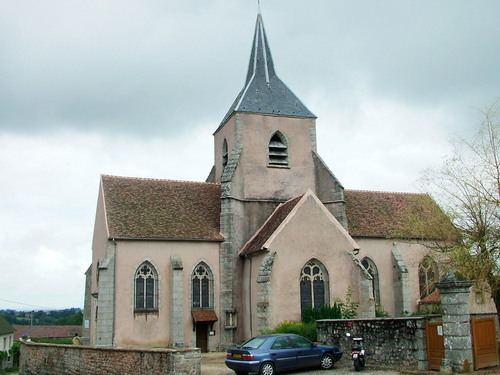
Sights
The church was restored in 1865 and has a functional bell tower. Saint-Léger-Vauban is also home to the Abbaye de la Pierre Qui Vire, and the Chateau de Rueres.
Economy
Saint-Léger's primary economic activity is farming, though there are several small shops, a post office, school, and multiple cheese makers.
References
Saint-Léger-Vauban Wikipedia(Text) CC BY-SA