
Time zone CET (UTC+1) Population 1,576 (1999) | Region Normandy Canton Criquetot-l'Esneval Area 18.82 km² Local time Tuesday 9:59 PM | |
 | ||
Weather 12°C, Wind S at 13 km/h, 79% Humidity | ||
Saint-Jouin-Bruneval is a commune in the Seine-Maritime department in the Haute-Normandie region in northern France.
Contents
Map of Saint-Jouin-Bruneval, France
Geography
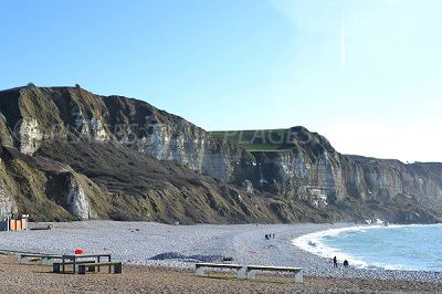
A farming village in the Pays de Caux, situated some 14 miles (23 km) north of Le Havre, at the junction of the D940, D139 and D111 roads. France’s 2nd largest oil-tanker port (built 1973-1975) and oil depot of ‘’Havre-Antifer’’ is entirely within the borders of the commune.
History
During World War II, Operation Biting (also known as the Bruneval Raid) was a successful Combined Operations raid to capture components of a German Würzburg radar set at La Poterie-Cap-d’Antifer and evacuated by the Bruneval beach on 27/28 February 1942.
Places of interest
References
Saint-Jouin-Bruneval Wikipedia(Text) CC BY-SA