
Area rank Ranked 9th Postcode district JE3 Area 8.7 km² | Time zone GMT Postcode sector 4 Population 2,911 (2011) | |
 | ||
Crown Dependency Jersey, Channel Islands Website www.parish.gov.je/st_john/ | ||
Saint John (Jèrriais: St Jean) is one of the twelve parishes of Jersey and is situated on the north coast of the island.
Contents
Map of St John, Jersey
Geography
St. John shares borders with St Mary on its west, Trinity to the east, and St Lawrence and Saint Helier on its south.
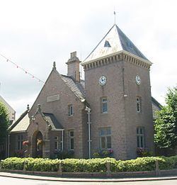
Largely a rural community, the parish has a small shopping area, and village pub, around its parish church and parish hall.
The cliffs of the north coast afford some of the best views in Jersey. After Trinity, it has the second highest point in Jersey at Mont Mado (473 ft). The parish covers territory of 4,846 vergées (8.7 km².).
Mont Mado granite was quarried historically. The largest quarry is now that of Ronez on the north coast.
La Route du Nord was constructed during the German occupation of the Channel Islands as a scheme to provide work. The road is now dedicated to the men and women of Jersey who suffered 1939-1945.
Vingtaines
The parish is divided into vingtaines for administrative purposes as follows:
The parish is one electoral district and elects one Deputy.
Twin towns
St John is twinned with:
St John Coat of Arms
The symbol for St John has links to the Crusades and the Maltese_cross# is used within Jersey to depict the Parish of St John.
Demographics
Saint John is the second least populated parish of Jersey, having only 2,911 residents as of 2011.