
Time zone EST (UTC−5) Area 124.2 km² Local time Tuesday 2:48 PM | Constituted October 9, 1976 Postal code(s) G0R 3E0 Population 5,023 (2011) Province Québec | |
 | ||
Weather 0°C, Wind E at 8 km/h, 94% Humidity | ||
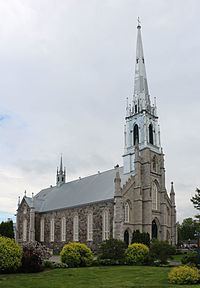
Saint-Henri is a municipality of 4,784 people, 20 km south of Lévis, in the Bellechasse Regional County Municipality. It is sometimes known as Saint-Henri-de-Lévis, and was historically known as Saint-Henri-de-Lauzon.
Map of Saint-Henri, QC, Canada
It used to belong to the former Desjardins Regional County Municipality, but decided to join Bellechasse in 2000 when the new city of Lévis was created. Saint-Henri felt it did not belong with a mostly urban RCM, and would fit better with Bellechasse, which has a largely rural base. Now, Saint-Henri is the biggest town in this RCM, followed by Saint-Anselme and Sainte-Claire. The Etchemin River crosses the municipality and one hydroelectric dam is found in Saint-Henri. On November 6, 1775, Benedict Arnold is said to have visited the village on his way to attack Quebec City. The largest local business is Olymel, a meat processing factory.