
Country France Time zone CET (UTC+1) Area 38.64 km² Population 245 (1999) | Region Occitanie Canton Aniane INSEE/Postal code 34261 /34150 Local time Tuesday 8:43 PM | |
 | ||
Weather 16°C, Wind W at 14 km/h, 63% Humidity Points of interest Saint‑Guilhem‑le‑Désert Abbey, Les gorges de l'Hérault, Musée de l'Abbaye, Grotte du Sergent | ||
Saint-Guilhem-le-Désert (Occitan: Sant Guilhèm dau Desèrt) is a commune in the Hérault department in the Occitanie region in southern France.
Contents
Map of 34150 Saint-Guilhem-le-D%C3%A9sert, France
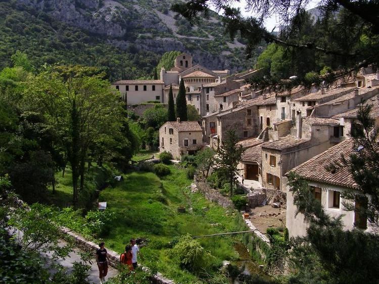
Situated in the narrow valley of the Gellone river where it meets the steep sided gorge of the Hérault River, Saint-Guilhem-le-Désert is essentially a medieval village located on the Chemin de St-Jacques (St. James's Way) pilgrim route to Santiago de Compostella.
History
The village has maintained its historic state. Because of its isolation, in 806 Saint Guilhem established the monastery of Gellone here.
Miscellaneous
Saint-Guilhem-le-Désert is one of the Plus Beaux Villages de France ("The most beautiful villages of France"), and the Abbey of Gellone, along with the nearby Pont du Diable were designated UNESCO World Heritages sites in 1999.
A part of the cloister of the monastery was moved to The Cloisters museum in New York City. A new sculpture museum, containing stone works from the abbey, was dedicated on June 26, 2009. In coordination with this event, a weekend of music and a colloquium was organized in large part by the Camerata Mediterranea.