
Intercommunality Vallée de Montmorency Area 242 ha Local time Tuesday 8:42 PM | Region Île-de-France Canton Saint-Gratien Time zone CET (UTC+1) Population 20,588 (2007) | |
 | ||
Weather 15°C, Wind SW at 10 km/h, 58% Humidity | ||
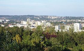
Saint-Gratien is a commune in the northern suburbs of Paris, France. It is located 13.8 km (8.6 mi) from the center of Paris.
Contents
Map of 95210 Saint-Gratien, France
History
On August 7, 1850, a part of the territory of Saint-Gratien was detached and merged with a part of the territory of Deuil-la-Barre, a part of the territory of Soisy-sous-Montmorency, and a part of the territory of Épinay-sur-Seine to create the commune of Enghien-les-Bains. On that occasion the commune of Saint-Gratien lost the scenic lake now known as the Lake of Enghien.
Transport
Saint-Gratien is served by Saint-Gratien station on Paris RER line and by the bus number 138 going to Paris — Porte de Clichy.
References
Saint-Gratien, Val-d'Oise Wikipedia(Text) CC BY-SA