
Area 9.26 km² Population 274 (1999) | Intercommunality Pays de Montfort Local time Tuesday 8:40 PM | |
 | ||
Weather 13°C, Wind S at 14 km/h, 72% Humidity | ||
Saint-Gonlay (Breton: Sant-Gonlei) is a commune in the department of Ille-et-Vilaine in Brittany in the northwest of France.
Contents
- Map of 35750 Saint Gonlay France
- Geography
- Population
- History
- Tourism
- Buildings and touristic places
- Sights
- References
Map of 35750 Saint-Gonlay, France
Geography
The Meu river goes through the town. There are 280 inhabitants in Saint-Gonlay and the territory stretches over 926 hectares.
In the North, there is the Meu river and the Comper river, in the East is the brook of Boutavent and in the South, the forest of Brocéliande.
The town is part of the county of Montfort-sur-Meu and depends of Rennes. It is surrounded by Montfort-sur-Meu, Bédée, La Nouaye, Breteil, Pleumeleuc, Talensac, Iffendic.
Rivers: The Comper The Meu Brooks: The Hélouin The Boutavent The Planchette Mountaintop: The Châtel (91 meters) The Lorinou (83 meters)
Population
Inhabitants of Saint-Gonlay are called gonlaysiens in French.
History
The parish of Iffendic separated in two and the town of Saint-Gonlay was founded. Its birth is probably due to the building of a church in the 13th century by two priests of Montfort-sur-Meu. A priory has also been built and it depends on Saint-Jacques de Montfort abbey.
Tourism
Tourism management in Montfort-sur-Meu" is entrusted by Montfort Community to the Tourist Office of the district of Montfort.
Buildings and touristic places
The schoolhouse is the former public house of Saint-Gonlay. In the past, it was a dynamic school of the district of Montfort. Nowadays, the school has been transformed into a small museum and shows a class from the 1950s. It also shows photos and presents souvenirs of the former schoolchildren, outdoor games, etc.
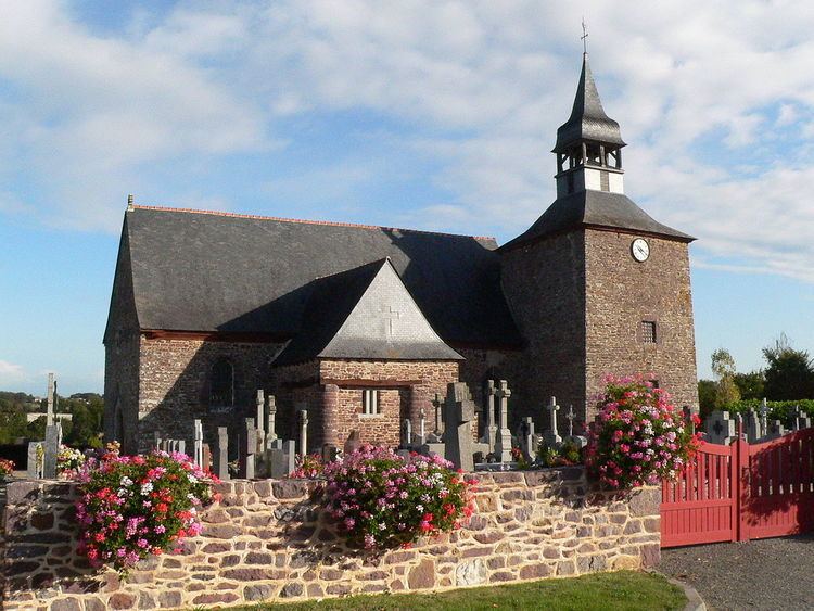
Surrounded by its cemetery, it is dated from the 16th and 17th century.
It was apparently dedicated to Saint-Gundlée, king of Glamorgan. We can notice of the front wall two characters facing each other: a confessor and a somebody confessing.
The house of Le Vilou is dated from the 18th century. It was considered at the time as a notable house. Indeed, back then, a subprefect of Montfort-sur-Meu lived there.
The castle of La Châsse is dated from the 17th century.
It was destroyed in 1595 during the French War of Religion, then rebuilt.
Sights
The path of schoolchildren The starting point is on the car park near the church and the town hall. The marking of the circuit is blue. It is 9 km long and goes up and down through the town of Saint-Gonlay and its villages, in the countryside. The hike lasts 2h15, follows the Meu river and offers many panoramas at different places on the circuit. We can then see the town centre of Iffendic, the forest of Broceliande, etc.