
Time zone CET (UTC+1) Local time Tuesday 7:36 PM | Region Occitanie Canton Mirepoix Area 10.51 km² Population 117 (1999) | |
 | ||
Intercommunality Vallée moyenne de l'Hers Weather 18°C, Wind N at 10 km/h, 44% Humidity | ||
Saint-Félix-de-Tournegat is a commune in the Ariège department in southwestern France.
Contents
Map of 09500 Saint-F%C3%A9lix-de-Tournegat, France
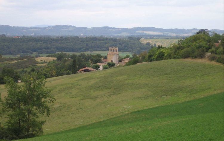
St-Félix-de-Tournegat is a small rural and very peaceful hilltop village. St Félix de Tournegat which includes the hamlets and farms of Barthès, Bel-Fort, Escapat, La Pujolle, Le Paradis, Les Seigneuries, Marvielle, Montagnac, Rigail, and Villerousse.
The village dates from the Iron Age and was occupied during Roman times. The Roman fortified church, dedicated to St Félix in the 13th Century has been beautifully restored, and is now a Classified Historic Monument.
Population
Inhabitants are called Saint-Félixans.
Sights
Just outside the village is the Domaine de Montagnac, a converted farm and former Equestrian Centre. Situated in its own private park (with private swimming pool), and with 135 acres (0.55 km2) of land all around, nowadays it has been converted into luxury accommodations.