Canton Revel Local time Tuesday 7:35 PM | Region Occitanie Area 51.88 km² | |
 | ||
Intercommunality Lauragais-Revel-Sorezois Weather 17°C, Wind N at 8 km/h, 48% Humidity | ||
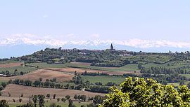
Saint-Félix-Lauragais is a commune in the Haute-Garonne department in southwestern France.
Contents
Map of 31540 Saint-F%C3%A9lix-Lauragais, France
History
The village was previously called Saint-Félix-de-Caraman or Carmaing. In 1167 the Cathars held a Council here, attended by many local figures and also by the Bogomil papa Nicetas, the Cathar bishop of (northern) France and a leader of the Cathars of Lombardy.
Sights
The Château de Saint-Félix-Lauragais is a 12th-century castle which is listed as a historical site by the French Ministry of Culture.
References
Saint-Félix-Lauragais Wikipedia(Text) CC BY-SA
