
Intercommunality Champsaur Area 15.01 km² Local time Tuesday 5:49 PM | Time zone CET (UTC+1) Population 2,054 (2012) | |
 | ||
Weather 17°C, Wind NW at 14 km/h, 35% Humidity | ||
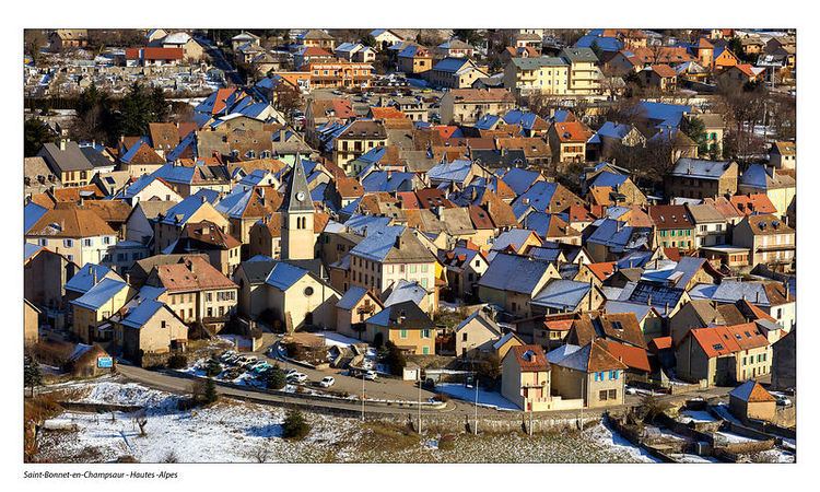
Saint-Bonnet-en-Champsaur is a commune in the Hautes-Alpes department in southeastern France. In January 2013 it merged with the former communes of Bénévent-et-Charbillac and Les Infournas.
Contents
Map of 05500 Saint-Bonnet-en-Champsaur, France
Geography
The commune is located at the mouth of the valley of the high Drac on the major route between Gap and Grenoble (route Napoléon) next to Écrins National Park. It is 15 km from Gap over the Col Bayard and 90 km from Grenoble. The commune forms a triangle of which the base is the Drac and the apex is Queyrel Peak. The landscape is primarily mountain pasture.
Population
The inhabitants are called Saint-Bonnetiers.
Vivian Maier
Street photographer Vivian Maier lived and photographed in the vicinity of Saint-Bonnet-en-Champsaur and Saint-Julien-en-Champsaur. While many details of Maier's life remain unknown, she was the daughter of a French mother, Maria Jaussaud, and several times during her childhood she moved between the U.S. and France, living with her mother in the Alpine village of Saint-Bonnet-en-Champsaur near her mother's relations. In 1935, Vivian and her mother, Maria, were living in Saint-Julien-en-Champsaur and prior to 1940 returned to New York City.
Climate
Located in the Haut-Dauphiné, Saint-Bonnet-en-Champsaur's climate is a mix of the Mediterranean and alpine.