
Canton Saint-Benoît-du-Sault Area 180 ha | Population (2009) 677 Local time Tuesday 5:41 PM | |
 | ||
Weather 18°C, Wind W at 11 km/h, 50% Humidity | ||
Saint-Benoît-du-Sault is a commune in the Indre department in central France.
Contents
Map of 36170 Saint-Beno%C3%AEt-du-Sault, France
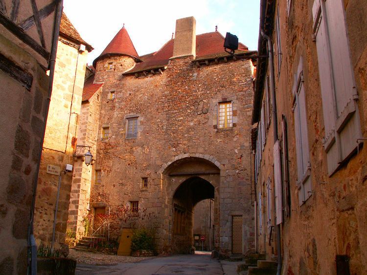
It is a medieval village, perched in a curve on a rocky butte overlooking the Portefeuille River in the former province of Berry. In 1988, it was named one of "the most beautiful villages of France."
History
Located in the area of Gaul settled by a powerful Celtic tribe, the Bituriges, "Kings of the World" (summa penes imperii bituriges), powerful until their defeat against Julius Caesar at Bourges (Avaricum), part of Roman Aquitania.
Two dolmens (Passebonneau and des Gorces) near to Saint-Benoît-du-Sault attest to the ancientness of human presence, if not of the Bituriges. Ten centuries later, in 974, some benedictine monks of Sacierges-Saint-Martin took refuge on a granite spur, where they founded a priory: Salis, future Saint-Benoît-du-Sault. From the 10th to the 17th century, the history of the priory and the new village is made up of resistance to the possessive desires of feudal neighbours, such as the Limoges and de Brosse family. The town was surrounded by a double line of ramparts. The first, the most ancient, protected the priory, the church and the fort, the second established in the 15th century, encircled the commercial part. Still today, its maze of narrow cobbled streets are a must to explore, and makes Saint-Benoît-du-Sault a beautiful medieval town.
Sights
Of architectural significance:
Personalities
People associated with Saint-Benoît-du-Sault: