
Time zone CET (UTC+1) Population 2,746 (1999) | Canton Saint-Aubin-du-Cormier Area 27.41 km² Local time Tuesday 5:17 PM | |
 | ||
Intercommunality Pays de Saint-Aubin-du-Cormier Weather 16°C, Wind SW at 24 km/h, 56% Humidity Arrondissement Arrondissement of Fougères-Vitré | ||
Saint-Aubin-du-Cormier (Breton: Sant-Albin-an-Hiliber) is a commune in the Ille-et-Vilaine department in Brittany in northwestern France.
Contents
Map of 35140 Saint-Aubin-du-Cormier, France
Geography
Saint-Aubin-du-Cormier is located at 29 km (18 mi) northeast of Rennes and 49 km (30 mi) south of Mont Saint-Michel.
The bordering communes are Mézières-sur-Couesnon, Saint-Jean-sur-Couesnon, Saint-Georges-de-Chesné, Mecé, Livré-sur-Changeon, Liffré, Gosné, Ercé-près-Liffré, and Gahard.
History
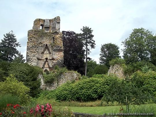
The area is most notable for the 1488 Battle of Saint-Aubin-du-Cormier, the decisive conflict of the guerre folle between rebellious feudal aristocrats and the French king. The rebels sought to resist the concentration of power in Paris and retain regional feudal independence. The combined rebel forces were defeated, paving the way for the creation of a unified French state.
The area was also the site of conflict during the Chouannerie, anti-Revolutionary insurrections in the 1790s.
Population
Inhabitants of Saint-Aubin-du-Cormier are called saint-aubinais in French.