
Department Ain Intercommunality Centre Dombes Area 20.73 km² Local time Tuesday 4:49 PM | Canton Reyrieux Time zone CET (UTC+1) Population 3,101 (1999) | |
 | ||
Weather 19°C, Wind N at 5 km/h, 35% Humidity | ||
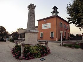
Saint-André-de-Corcy is a commune in the Ain département in eastern France.
Contents
Map of 01390 Saint-Andr%C3%A9-de-Corcy, France
Sites and monuments
The commune has several châteaux and poypes (fortified mounds, or mottes). The motte castrale Poype Les Roussière has been listed as monument historique by the French Ministry of Culture since 1989. The Château de Montribloud a castle converted to a residence, dates from the 14th century.
References
Saint-André-de-Corcy Wikipedia(Text) CC BY-SA