
Country Thailand Muban 57 Postal code 71150 Population 62,212 (2015) Geocode 7102 | Tambon 7 Time zone ICT (UTC+7) Area 2,729 km² Province Kanchanaburi Province | |
 | ||
Sai Yok (Thai: อำเภอไทรโยค (Pronunciation)) is a district (amphoe) in the Kanchanaburi Province in western Thailand.
Contents
- Map of Sai Yok District Kanchanaburi Thailand
- Geography
- Sights
- Central administration
- Local administration
- Popular culture
- References
Map of Sai Yok District, Kanchanaburi, Thailand
Geography
The district is in the valley of the Khwae Noi River in the Tenasserim Hills area. It borders Myanmar to the south. Along the river the Death Railway runs till Nam Tok Sai Yok Noi.
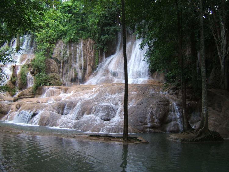
Sai Yok National Park was created on 27 October 1980 and covers an area of about 500 km². The most famous sight in the park is the Sai Yok waterfall.
Neighboring districts are (from north clockwise) Thong Pha Phum, Si Sawat, Mueang Kanchanaburi of Kanchanaburi Province and Tanintharyi Division of Myanmar.
Sights
Apart from the nature of the Kwae Noi river valley, the other main attraction is the Mueang Sing Historical Park, which shows the westernmost Khmer-style temple complex. Also popular for tourists is the Tiger Temple.
Central administration
The district Sai Yok is subdivided into 7 subdistricts (Tambon), which are further subdivided into 57 administrative villages (Muban).
Local administration
There are 3 subdistrict municipalities (Thesaban Tambon) in the district:
There are 6 subdistrict administrative organizations (SAO) in the district: