
Irish Grid Reference O034266 Local time Tuesday 2:35 AM | Elevation 125 m Population 2,144 (2011) | |
 | ||
Weather 6°C, Wind SE at 10 km/h, 95% Humidity | ||
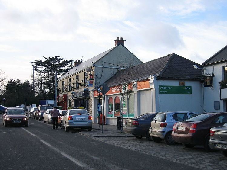
Drury mills saggart village co dublin
Saggart (Irish: Teach Sagard) is a suburban village in South Dublin, Ireland, south west of Dublin city. It lies between the N7 (Naas Road), Rathcoole, and Tallaght. It was the fastest growing town between the census of 2006-2011 with and increase of nearly 150 per cent
Contents
- Drury mills saggart village co dublin
- Map of Saggart Co Dublin Ireland
- Saggart dublin view
- Name
- History
- Historical artifacts
- Nature
- Parish
- Amenities
- Luas
- Bus
- Sport
- Politics
- References
Map of Saggart, Co. Dublin, Ireland
Saggart dublin view
Name
A monk called Mosacra founded a settlement on the site of the village in the 7th century. The name Saggart derives from Teach Sacra which means 'house of Sacra' in Irish. For many years Saggart was known as Tassagard or Tassagart, and the latter name persists in Tassagart House, and in the names of some housing estates in the area.
History
A monastery existed just outside the village in the 7th century. The remains of this monastery are found on the grounds of an equestrian centre approximately 1.5 km from today's Saggart Village. After St Mosacra died, it became a nunnery with over 80 nuns living there until the Viking attacks of the 9th century.
By 1207, Saggart, or Tasagart, as it was then called by the Normans, had been made a prebend of the Cathedral of St. Patrick. In 1615, the church was reported as being in good repair but fifteen years later the church is stated to have fallen down, and the Protestant parishioners attended Rathcoole church. The current church was built in 1847.
From 1888-1932, the Dublin to Blessington tram service stopped at Saggart.
Historical artifacts
Some well-known objects of archaeological interest can be found in Saggart.
There are four surviving pre-Norman monuments in the village:
All of these monuments stand in the graveyard, sited across Garter Lane from the Roman Catholic Church. The graveyard predates the current church and is located on the site of previous church buildings, although believed to be the monastery of St Mosacra, the actual site is 1.5 km away. The first edition Ordnance Survey map from 1843 shows the graveyard to be oval in shape, with access provided by a lane leading directly from the village; prior to this, the area is recorded by mapmakers as the site of a ruined church. Within the graveyard, there is a noteworthy memorial to Dublin merchant Edward Byrne, who was a member of the Catholic Committee, which included Wolfe Tone, which petitioned King George II in 1793 on behalf of the Irish people.
Nature
Saggart lies at the northern end of a mountain valley, the Slade of Saggart with Brittas at the other side. The River Camac flows through this valley, passing around the village on the way to meet the River Liffey by Heuston Station. The great spotted woodpecker, Ireland's newest breeding bird, has been seen here.
Parish
Dedicated in 1849, the Roman Catholic Church is named after "The Nativity of the Blessed Virgin Mary". The current Parish Priest is Rev. Enda Cunningham. The parish boundaries include the areas of Rathcoole and Brittas and works in conjunction with the neighbouring parish of St. Finian's, Newcastle.
Amenities
Saggart is a heritage village and home to the Citywest Hotel, which hosts many annual events including the Irish Masters, award ceremonies, and political ard fheiseanna.
Citywest Business Park is located just to the north of Saggart village and is home to many companies, and to a Dublin City University facility.
Jacob’s Bar was established as a public house in the village by members of the Jacob family in 1901 and has since established itself as a local landmark.
Coolmine Equestrian centre and CEAD-Ireland host equestrian based activities & competitions and host CEAD-Fest during the summer months
Luas
Saggart is one of two termini for the Luas Red Line. The other terminus is Tallaght. The line provides a direct link to Dublin city with a journey duration of 45 minutes.
Bus
Saggart is served by the Dublin Bus 69 service.
Sport
St. Marys is the local Gaelic Athletic Association club and was founded in 1906.
Coolmine Equestrian Centre was established here in 1989. The equestrian centre is home to the remains of the 7th century monastery of St Mo Sacra.
Politics
For elections to Dáil Éireann, Saggart is part of the Dublin Mid-West constituency. Saggart, along with Citywest, Rathcoole and Newcastle, is part of the Clondalkin Local Electoral District of South Dublin County Council.