
Postal code 7122/7104/7107/7106 Elevation 1,315 m Sfos number 3672 | Canton Graubünden Area 151.4 km² District Surselva Region | |
 | ||
Surrounded by Castrisch, Flims, Riein, Sagogn, Bonaduz, Präz, Rhäzüns, Trin, Casti-Wergenstein, Duvin, Flerden, Mathon, Nufenen, Pitasch, Portein, Sankt Martin, Sarn, Splügen, Sufers, Tschappina, Vals Website http://gemeinde.safiental.ch SFSO statistics | ||
Safiental
Safiental is a municipality in the Surselva Region in the canton of Graubünden in Switzerland. The municipalities of Valendas, Versam, Safien and Tenna merged on 1 January 2013 into the new municipality of Safiental.
Contents
- Safiental
- Map of 7122 Safiental Switzerland
- Jugendzeit erinnerungen ans safiental gr 1951 1953
- History
- Geography
- Demographics
- Historic Population
- Heritage sites of national significance
- Transportation
- In Popular Culture
- References
Map of 7122 Safiental, Switzerland
Jugendzeit erinnerungen ans safiental gr 1951 1953
History
Valendas is first mentioned in 765 as in Valendano. Versam is first mentioned in 1050 as a valle Versamia. Safien is first mentioned in 1219 as Stosavia. Tenna is first mentioned in 1398 as Thena.
Formerly inhabited by Romansh speakers, it was settled by the Walser in the late 13th century. Population fell from 1,798 in 1850 to 994 in 1980 and has since stabilized just around 1,000.
Geography
The former municipalities that make up Safiental had an area of 151.42 km2 (58.46 sq mi).
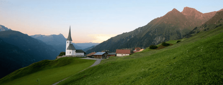
The municipality contains the Safien valley, an alpine valley of the Canton of Graubünden, branching off the Vorderrhein valley.
Safien had an area, as of 2006, of 100.6 km2 (38.8 sq mi). Of this area, 45.6% is used for agricultural purposes, while 18.2% is forested. Of the rest of the land, 0.8% is settled (buildings or roads) and the remainder (35.4%) is non-productive (rivers, glaciers or mountains). Safien was the capital of the Safien sub-district of the Surselva district in the mid and upper Safien valley. The valley is drained by the Rabiusa river. The former municipality consists of the village of Safien-Platz (elevation: 1,350 m (4,430 ft)) and scattered hamlets and single farm houses throughout the valley.
Tenna had an area, as of 2006, of 11.3 km2 (4.4 sq mi). Of this area, 45.1% is used for agricultural purposes, while 34% is forested. Of the rest of the land, 1.1% is settled (buildings or roads) and the remainder (19.8%) is non-productive (rivers, glaciers or mountains). It is a German-speaking collection of small settlements on a terrace above the west side of the Safien valley. It consists of the village of Tenna which is made up of the sections of Ausserberg, Mitte and Innerberg as well as the hamlets of Acla and Egschi along the valley road.
Valendas had an area, as of 2006, of 22.8 km2 (8.8 sq mi). Of this area, 21.6% is used for agricultural purposes, while 48.7% is forested. Of the rest of the land, 1.8% is settled (buildings or roads) and the remainder (27.9%) is non-productive (rivers, glaciers or mountains). It is located above the right side of the Vorderrhein canyon. It consists of the haufendorf village (an irregular, unplanned and quite closely packed village, built around a central square) of Valendas and the hamlets of Carrera, Brün, Dutjen and Turisch.
Versam had an area, as of 2006, of 16.8 km2 (6.5 sq mi). Of this area, 16.8% is used for agricultural purposes, while 70.6% is forested. Of the rest of the land, 2% is settled (buildings or roads) and the remainder (10.6%) is non-productive (rivers, glaciers or mountains). It is located above the Vorderrhein canyon at the entrance to the Safien Valley. It consists of the linear village of Versam and the hamlets of Versam-Station, Arezen, Calörtsch and Sculms.
Demographics
The total population of Safiental (as of December 2015) is 896.
Historic Population
The historical population is given in the following chart:
Heritage sites of national significance
The Türelihus and the Haus Joos with attached barn in Valendas and the Swiss Reformed Church in Tenna are listed as Swiss heritage sites of national significance.
The Türelihus (Türeli House) is located in the center of Valendas and is one of the most historically valuable houses in the village. The interior contains many of the original furnishings from the Renaissance and Baroque eras. The original building was constructed in 1485. In 1554 it was expanded, this expansion was known as the Renaissance phase, with a spiral staircase within a tower and a stable was added to the north side. In 1775 it was renovated in the baroque style. The four-story building was abandoned for many years and had begun to decay. In 1994, the first attempt to renovate this building ended with only the addition of a temporary roof.
The oldest part of the Haus Joos may date to about 1300. The attached barn has a date of 1572 carved into it. However, the building is currently in poor condition and has not been used for a number of years.
Transportation
Versam-Safien, the nearest Rhaetian Railway station, is located about 3.6 km (2.2 mi) from Versam. It is located on the Vorderrhein valley floor while Versam in on the heights above the station. To reach the village directly, there are two Postauto bus stops in the village.
In Popular Culture
The 2012 feature film The Hour of Living is largely set in Safiental, with especially Grossalp Piggamad, as well as Z'hinderst, Bodaälpli and Alperschällihorn with its Gletscherseeli all serving as prominent locations.