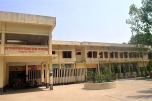
Area 228 km² | Time zone BST (UTC+6) | |
 | ||
Website Official Map of Sadullapur | ||
Sadullapur (Bengali: সাদুল্লাপুর) is an Upazila of Gaibandha District in the Division of Rangpur, Bangladesh.
Contents
Map of Sadullapur Upazila, Bangladesh
Geography
Sadullapur is located at 25.3833°N 89.4667°E / 25.3833; 89.4667. It has 47,102 homes and total area 227.97 km².
Demographics
As of the 1991 Bangladesh census, Sadullapur has a population of 243,012. Males constitute 50.4% of the population, and females 49.6%. Upazila's adult population, over 18 years, is 117,347. Sadullapur has an average literacy rate of 25.1% (7+ years), below the national average of 32.4%.Tha literacy rate of this upazila is 89.3 .
Administration
Sadullapur Upazila is divided into 11 union parishads:Idelpur, Banagram, Bhatgram, Damodarpur, Dhaperhat, Faridpur, Jamalpur, Kamar Para, Khurda Kamarpur, Naldanga, and Rasulpur. The union parishads are subdivided into 166 mauzas and 168 villages.
