
Country Vietnam Capital Sa Pa Area 677 km² Province Lao Cai Province | Region Northeast Time zone UTC + 7 (UTC+7) Population 42,095 (2003) Local time Monday 4:25 PM | |
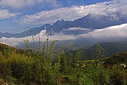 | ||
Weather 12°C, Wind SE at 10 km/h, 77% Humidity Points of interest Silver Waterfall, Notre Dame Cathedral, Sapa love market, Thung Lũng Mường H, Bãi đá cổ Sa Pa | ||
Sa Pa ( listen) is a rural district of Lào Cai Province in the Northeast region of Vietnam. As of 2003, the district had a population of 42,095. The district covers an area of 677 km². The district capital lies at Sa Pa.
Contents
Map of Sa Pa, Lao Cai, Vietnam
Administrative divisions
Sa Pa contains the city (thị trấn) of Sa Pa and the communes of Hầu Thào, Bản Phùng, Tả Phìn, Nậm Sài, Thanh Phú, Sa Pả, Lao Chải, Trung Chải, San Sả Hồ, Thanh Kim, Bản Hồ, Sử Pán, Suối Thầu, Tả Van, Bản Khoang, Tả Giàng Phình and Nậm Cang.
References
Sa Pa District Wikipedia(Text) CC BY-SA