
Country Thailand Seat Niyom Chai Postal code 15240 Area 304.6 km² | Province Lopburi Time zone THA (UTC+7) Geocode 1608 Population 21,279 (2005) | |
 | ||
Sa Bot (Thai: สระโบสถ์, [sàʔ bòːt]) is a district (Amphoe) in the northern part of Lopburi Province, central Thailand.
Contents
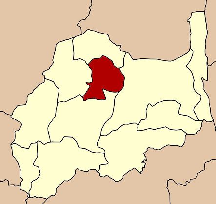
Map of Sa Bot District, Lopburi, Thailand
History
The minor district (King Amphoe) was created on June 5, 1981, by separating the tambon Sa Bot, Maha Phot and Tha Thung Chang of Khok Samrong district. It was upgraded to a full district on January 1, 1988.
Geography
Neighboring districts are (from the north clockwise) Khok Charoen, Chai Badan, Khok Samrong and Nong Muang.
Administration
The district is subdivided into 5 subdistricts (tambon), which are further subdivided into 46 villages (muban). Sa Bot itself has township (thesaban tambon) status and covers all of the tambon Sa Bot. There are 3 Tambon administrative organizations (TAO) - Sa Bot, Maha Phot and Niyom Chai.
References
Sa Bot District Wikipedia(Text) CC BY-SA